
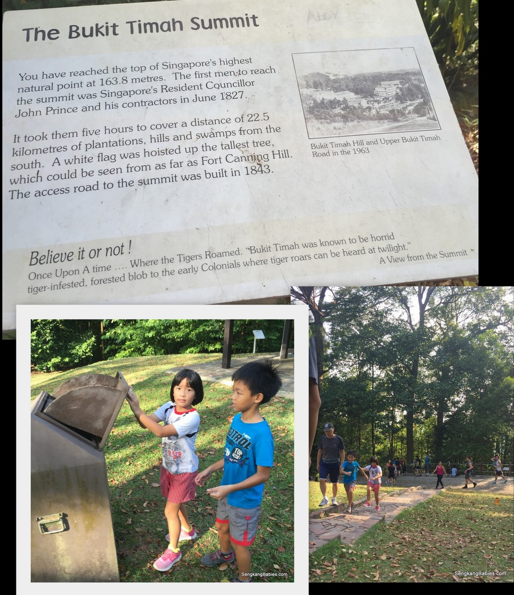
Bukit Timah Hill is Singapore’s highest hill. At 163m, some might not associate the climb up as hiking.
But this hill will still make you breathless and your heart pounds faster.
The proper way to ascend a hill (same for mountain) is slow and easy, if our body cannot acclimatise to new heights even athletes will succumb to fatigue. Alas, the kids will always ignore parents’ advice and treat every adventure like a 100m sprint, quickly losing their reserve energy hee hee.
Bukit Timah Hill is popular with nature lovers over the weekends (ie no more carpark space).
We reach the summit in 20 minutes (kids were a bit eager), you can do it comfortably in under 30 minutes.
Fitness buffs love to train on the hill’s steep inclines and steps.
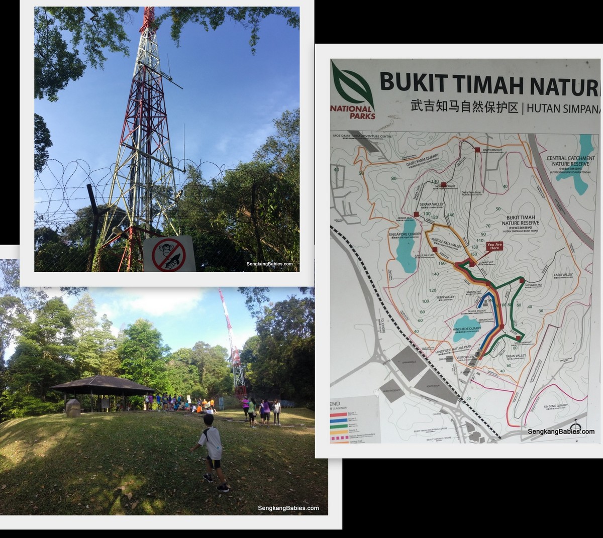
Partial Bukit Timah Hill Park map.
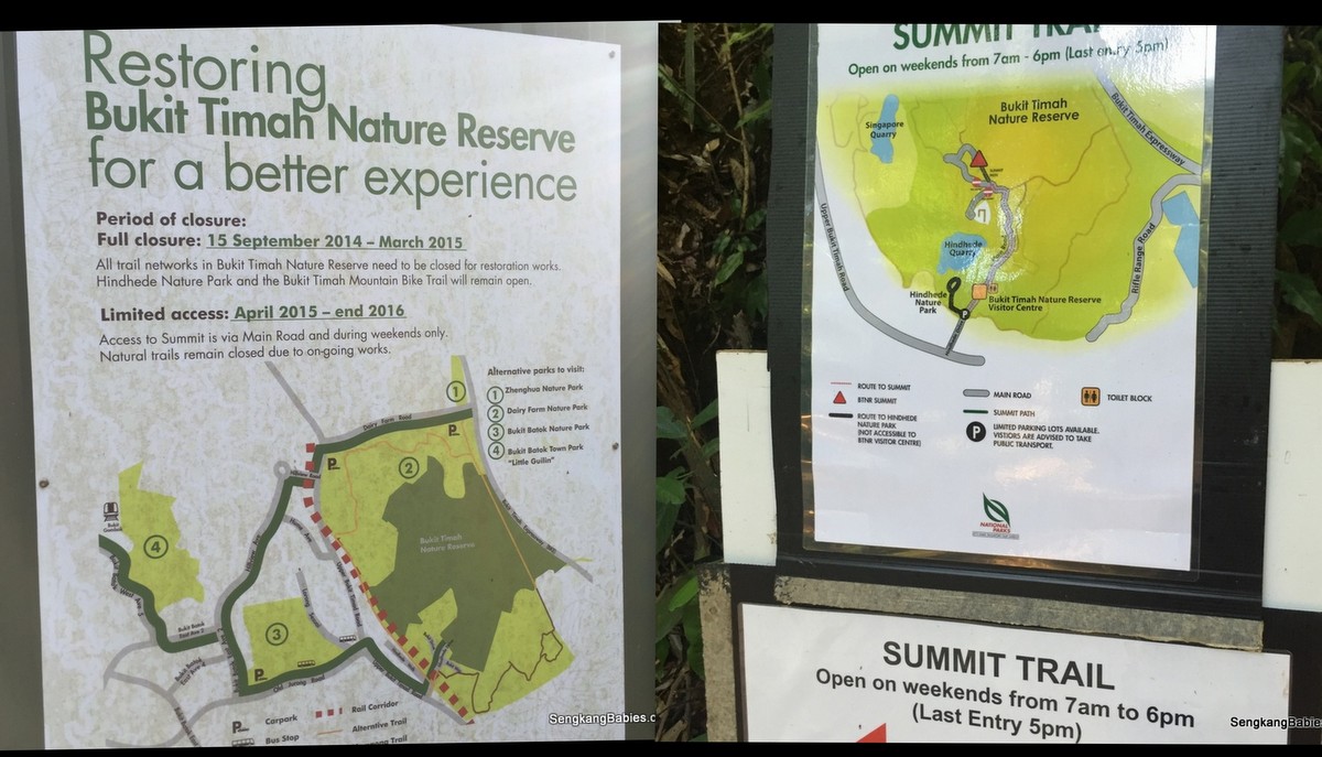
As restoration is in progress (till end 2016), only Summit Trail is open to public on weekends, from 7am to 6pm.

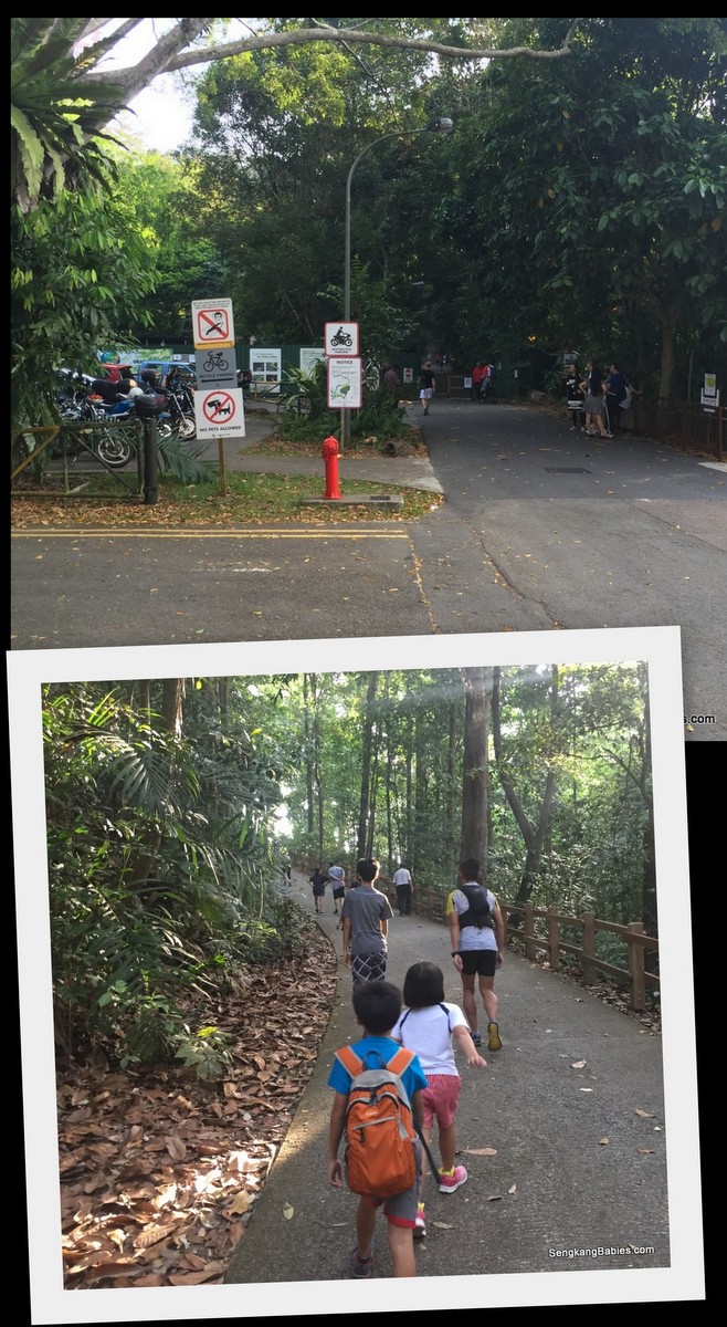
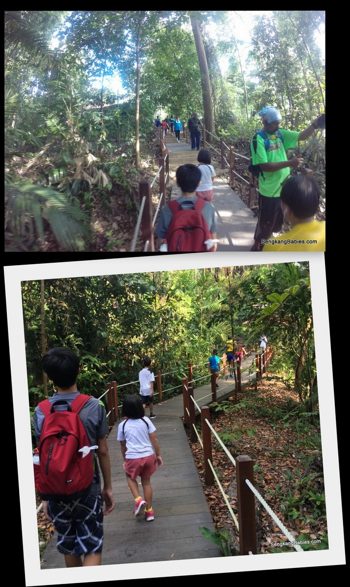
Only one way to go, UP the steep incline ! The first two slopes are easily 40 to 50 degree incline, and they will sap up to 60% of your overall “hiking” energy. Distance is about 1.7km to the summit., go SLOW (haha) and everyone shall enjoy the greens.
Starting point is just next to the carpark.
After the slope, the steps welcome us. Going up is tiring but relatively easier compare to coming down. Go slow when descending as you do not want your knee to absorb too much “jumps”.
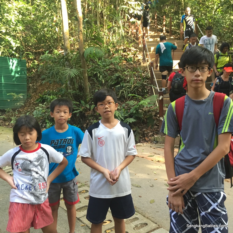
Some folks will be running up and down the steps, keep one side to avoid injury and falls to you or them. Kids are visibly tired after the steps :p
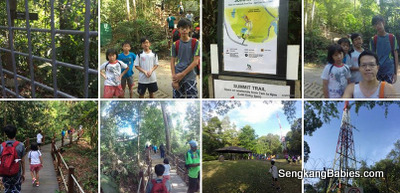
Before you know it (or before the kids caught their breaths) we see the radio masts. There is quite a crowd at Bukit Timah Hill summit.
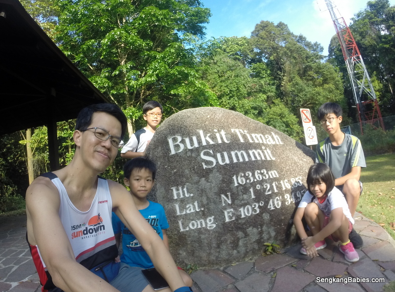
Take a photo with the GPS stone, “been there done that”. Rest and enjoy some fresh air. Kids also ask me why the dustbin is so hard to open 🙂
Video (link) : Hike Up Bukit Timah Hill summit
Going down slope, some of the kids follow fellow hikers and walk backwards haha.

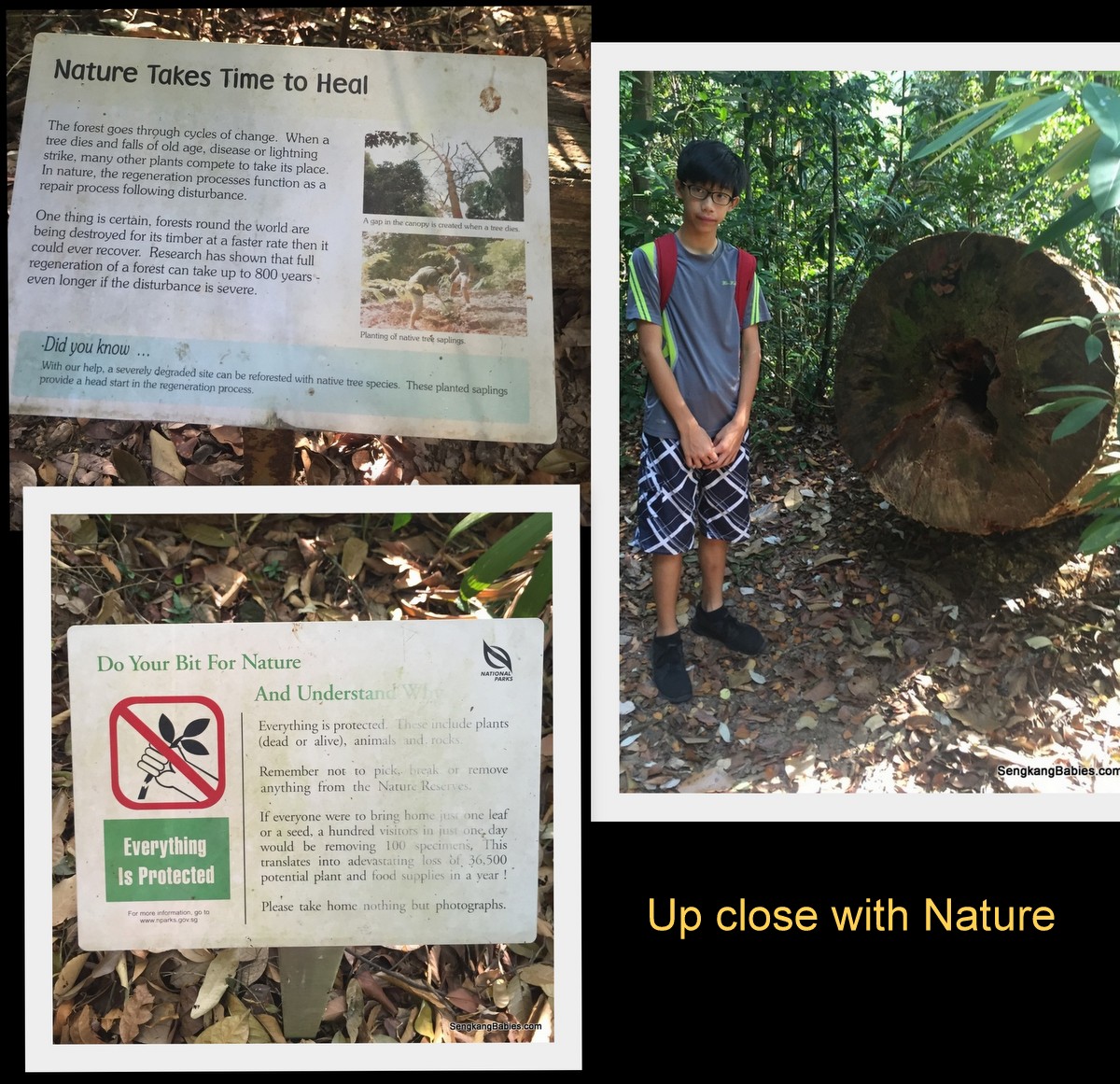
Learn about Bukit Timah Hill flora and fauna from the boards.
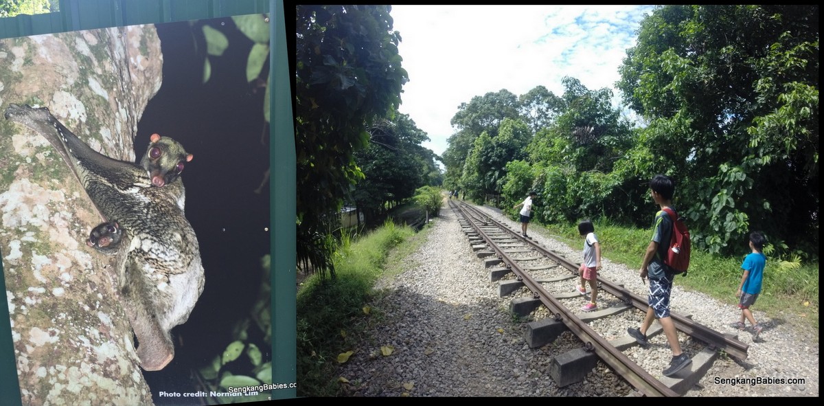
We spotted the flying lemur on the tree too, it is only active in the night. Remains of the old railway along Green Corridor.
Linked by Park Connector, the nature reserves around Bukit Timah are very popular with mountain bikes.

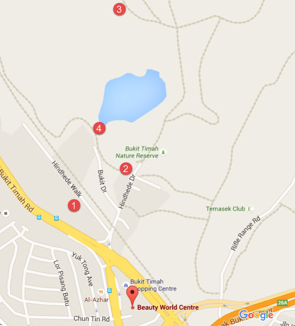
Map of Bukit Timah hill and Hindhede Park.
(1 & 2)- you can park at this two locations
3) Bukit Timah Hill Summit (estimated)
4) Hindhede Park Quarry view (estimated), entry is behind carpark (point 2)
More tips :
– GPS for start of Bukit Timah Hill – 1.347945, 103.776609
– Carpark is small, park along Hindhede Walk
– Keep to the left on the path
– Wear comfortable shoe, prepare mosquito patch
– Hydration, it can be humid under the canopy
– Spend 90 minutes max on Summit Trail (up and down), the kids will prefer Hindhede trail and lookout point! (path starts behind carpark).
More photos of Bukit Timah Hill summit and Hindhede Park uploaded on our Fanpage album.
We believe that active lifestyle helps families to bond and stay healthy.
Follow our Running and Cycling pursuits, Hiking is next 🙂