Hiking in Singapore – Kampong, Durian and Chestnut

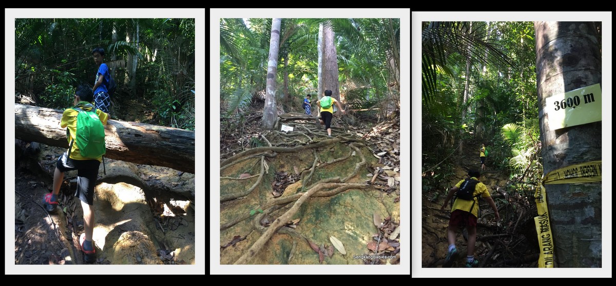
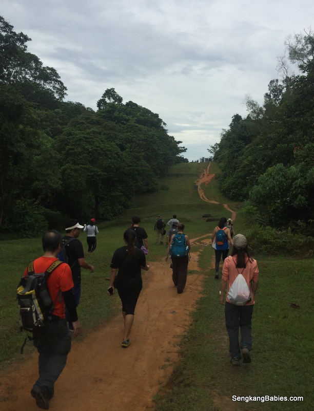
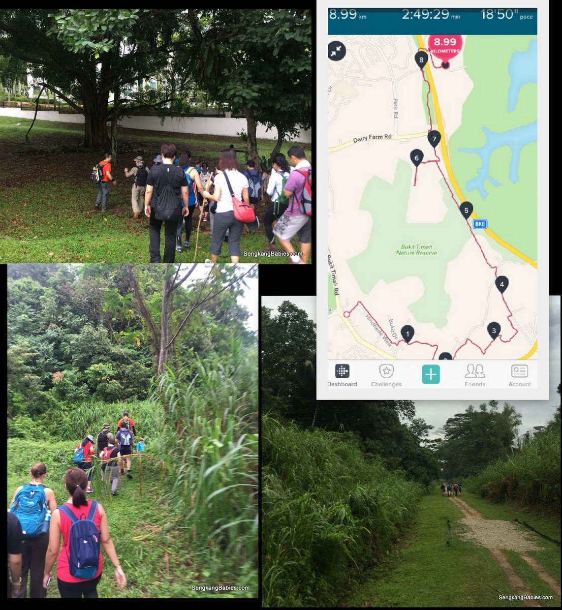
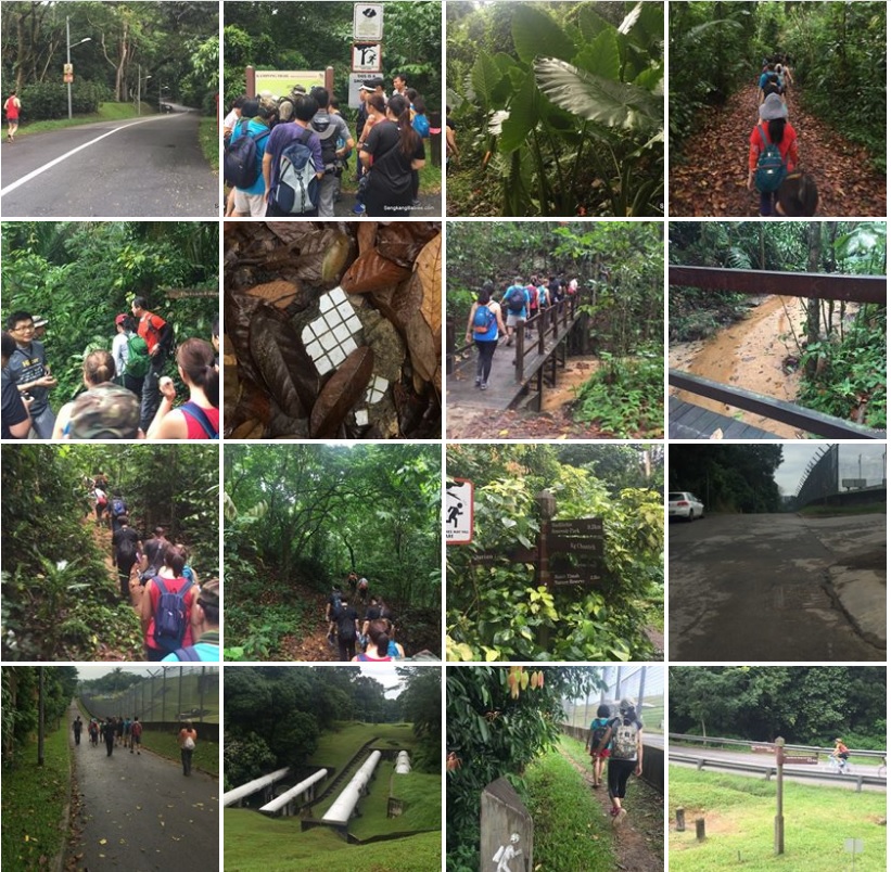
Hiking in Singapore, fellow trekkers walking along Belukar Track this morning. Our total trail covers a few parks, lasted 4 hours, around 10km, 20k steps.
img_0051

The interesting invite from Meetup SANL group 🙂
The Kampong, Durian, Chestnut trails were all new to me, and I never knew hiking in Singapore could be so much FUN!
singapore-adventures-nature-lovers-invite-to-chestnut

This is the rough direction, Springdale (along Upper Bukit Timah Road)-> Kampong Trail (near to BukitTimah Hill’s slope) along Serapong Link -> Rifle Range Road -> Murnane Reservoir -> Belukar Track (mountain bikes and huge water pipes) -> Dairy Farm for toilet break -> ZhengHua via Hillview Park Connector -> Chestnut Avenue (walk under Bukit Timah expressway) -> Chestnut Nature Park (South) -> Bukit Panjang lunch
hiking-singapore

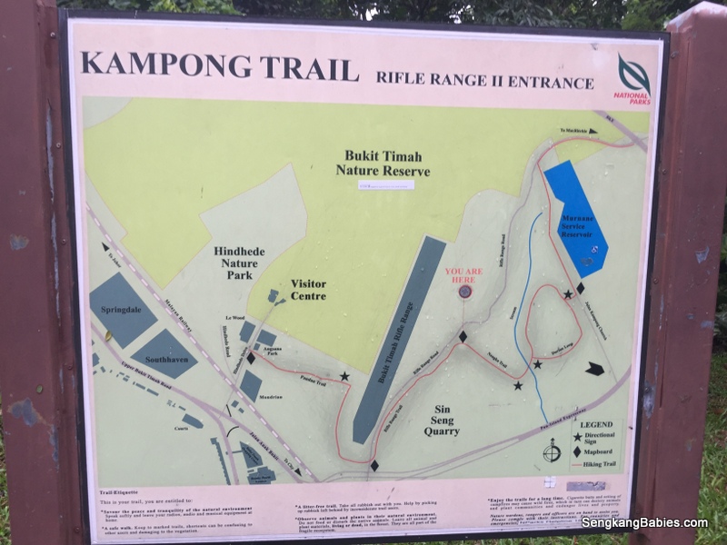
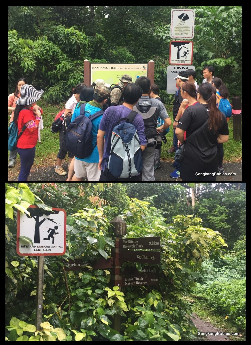
Kampong Trail map (GPS 1.346183, 103.775870) entrance is very near to Bukit Timah Hill (slope).
20161016-trail-durian-chestnut

Map below, follow the Red Line for the first Kampong trail ->, Pandan, Rifle Range, Nangka, finally Durian loop.
kampong-trail-map

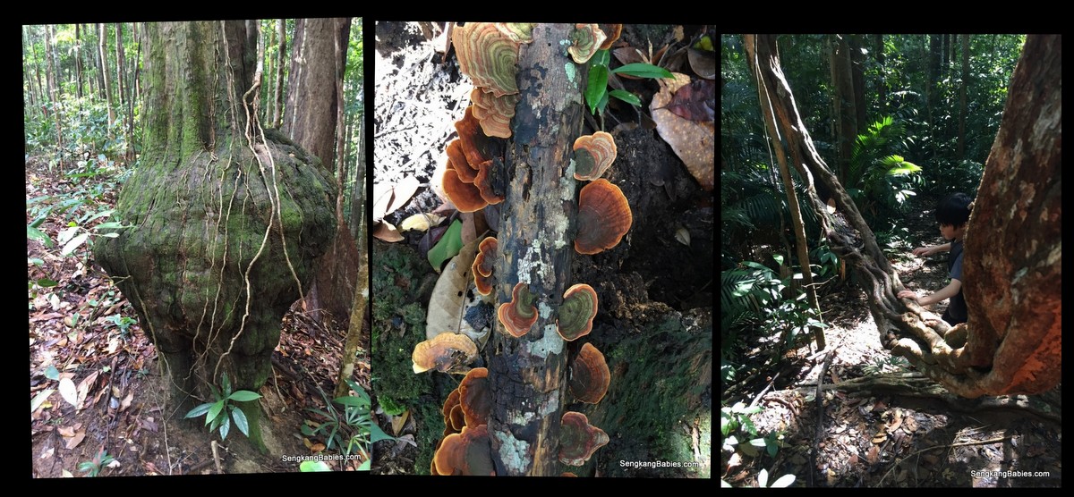
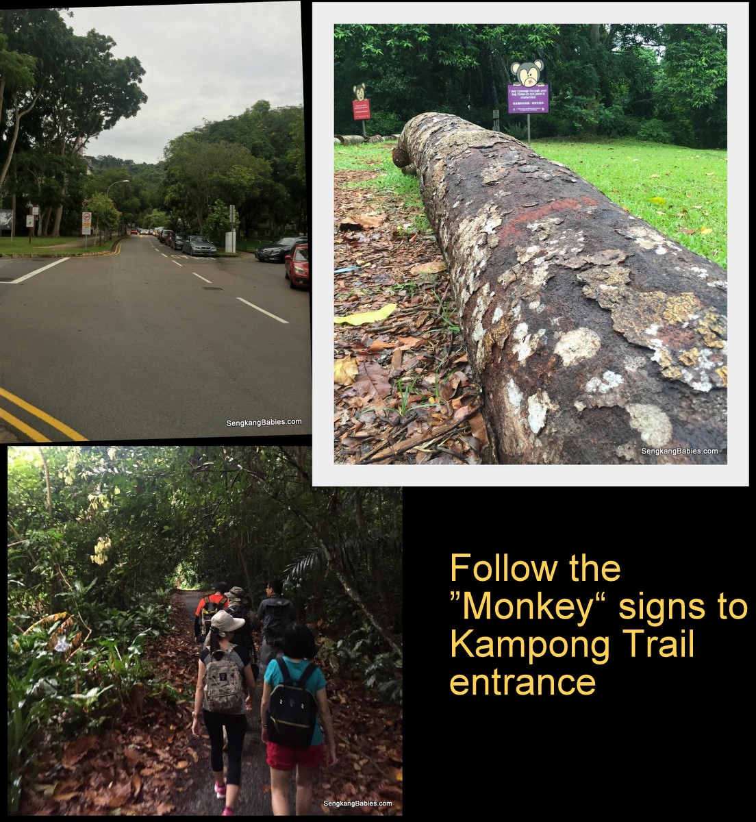
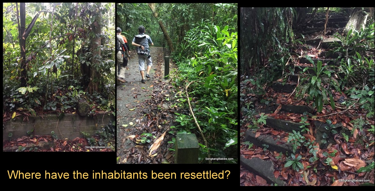
Old kampong, we can see remnants of the old inhabitants. Steps, wall, ceramic floors etc. It sort of remind me of Bukit Brown trail.
20161016-trail-durian-chestnut1

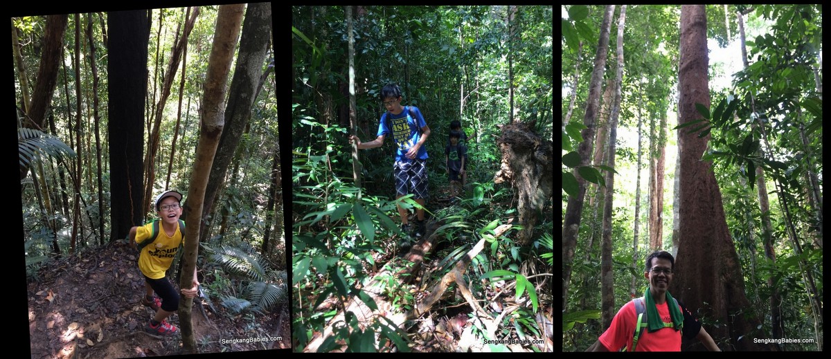
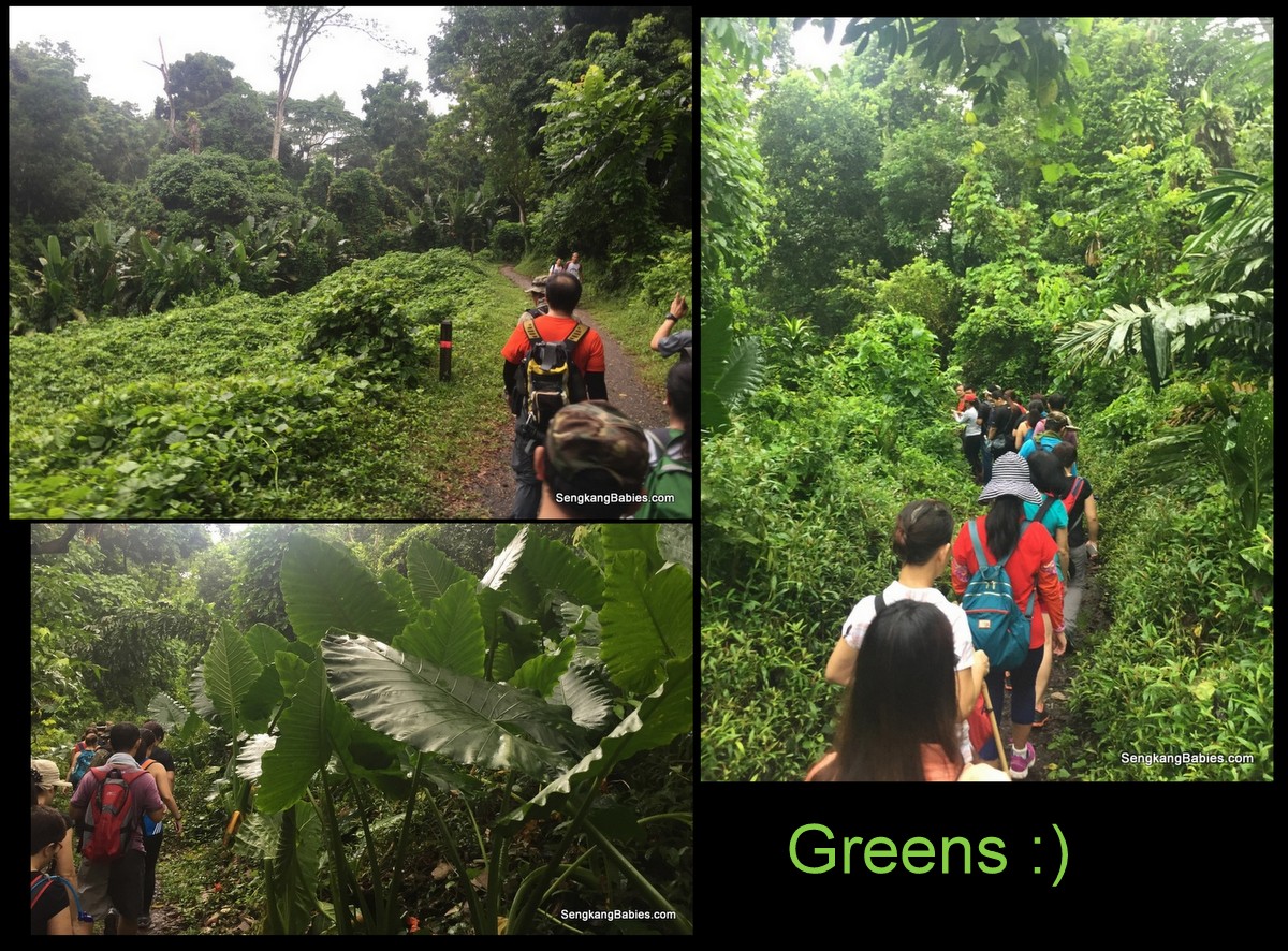
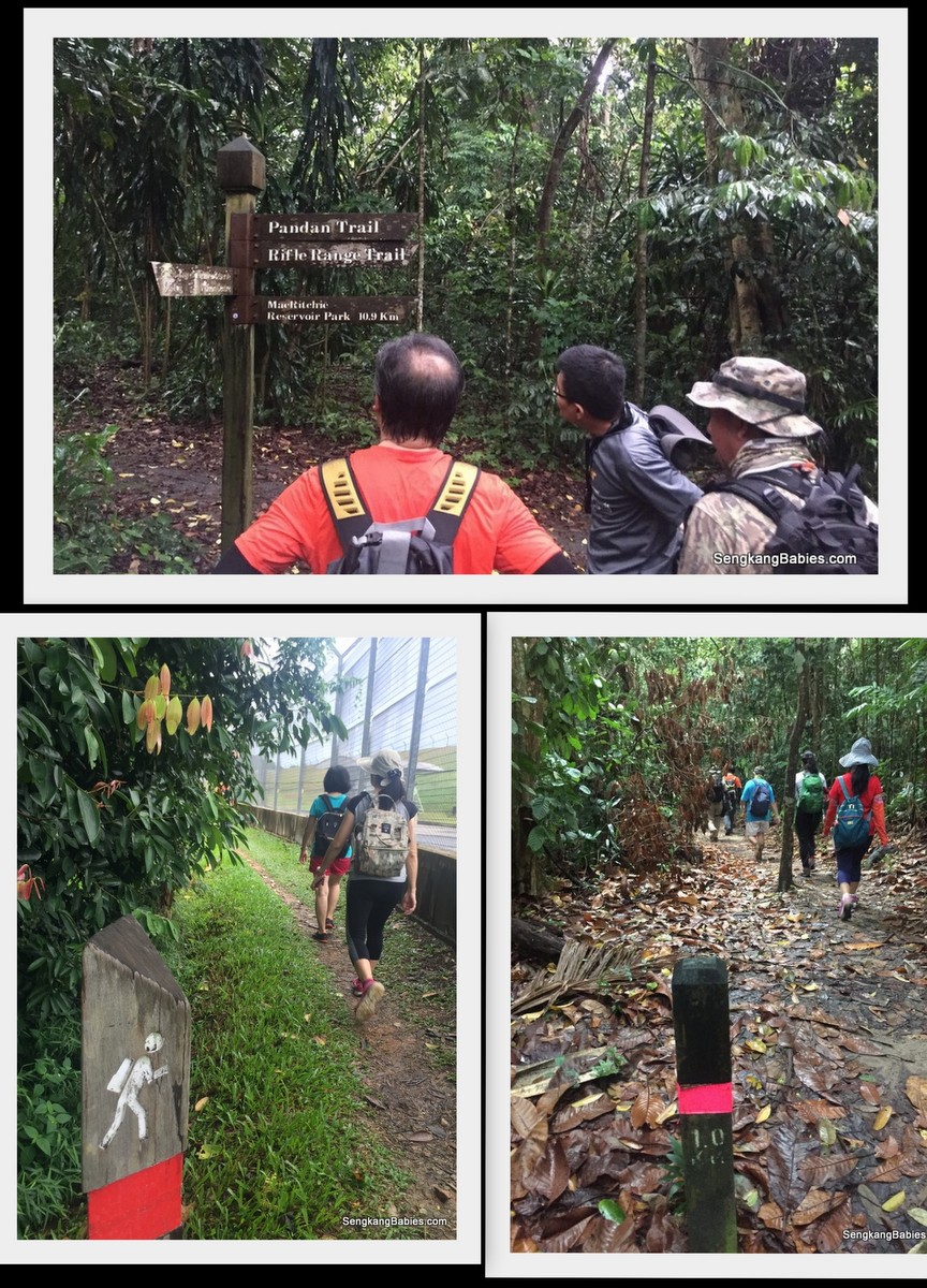
Enjoying the greens, we are still walking on tarmac. Hard to find one nature spot in Singapore which is unexplored yet.
durian-loop-hiking

I still prefer tramping on mud paths and trails over hard tarmac any day 🙂
20161016-trail-durian-chestnut4

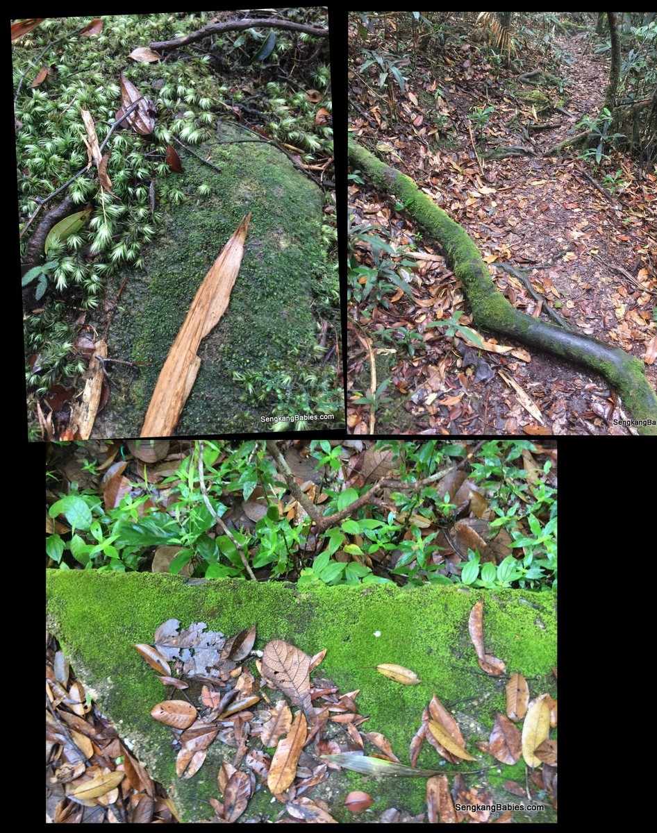
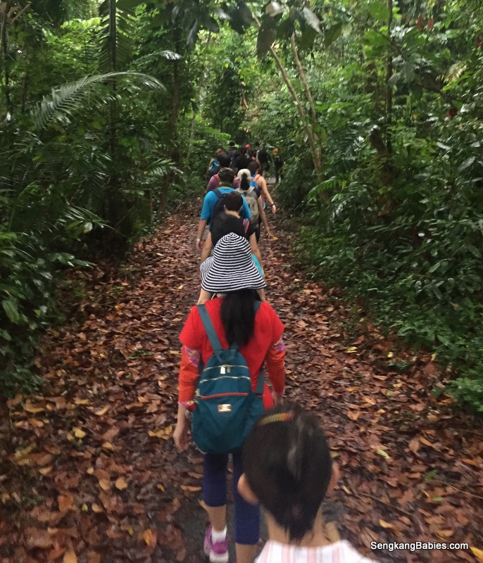
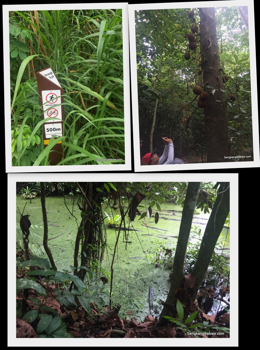
We encountered some fallen trees, walking inside rainforest carpeted by dead leaves. You will also come across a lot of trail runners, some with dogs.
img_9973

Hard to lose yourself, as there are always signs and direction clues.
20161016-trail-durian-chestnut6
20161016-trail-durian-chestnut5

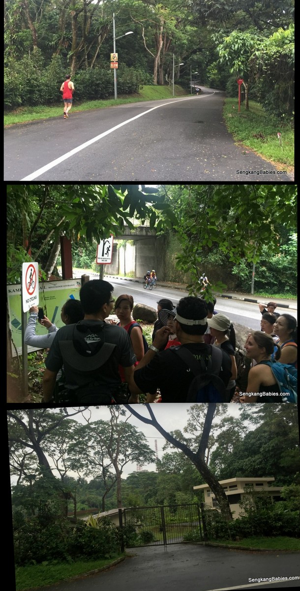
Proceed parallel along Rifle Range road, which is very popular with trail runners and cyclists. Atas Temasek club spotted.
20161016-trail-durian-chestnut3

In case you are wondering, Durians trees are real but you have to wait for the season. We heard regulars would have already “chope” book their favourite harvesting spots.
img_9975

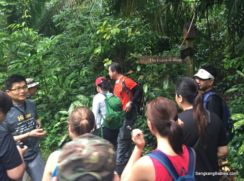
We exit Durian Loop next to Murnane Service Reservoir (I have never heard of this reservoir before).

We were informed about Rambutan season, might not be a bad idea to pluck some to enjoy along the hike.
20161016-trail-durian-chestnut7

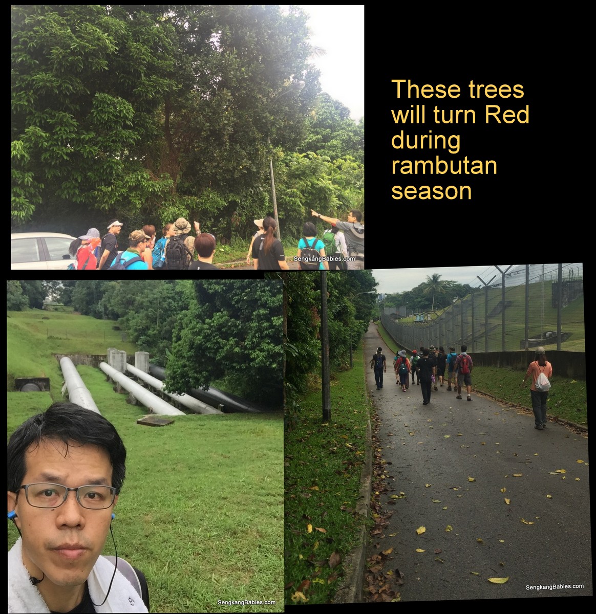
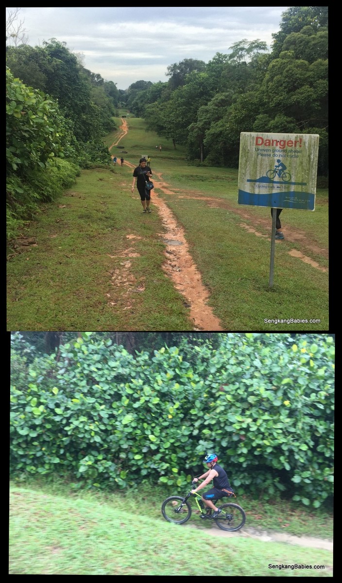
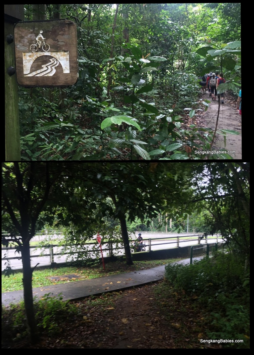
The water pipes and mountain bike trails are along Belukar Track (Nparks Mountain Biking map, refer point 17 and 18).
20161016-trail-durian-chestnut8

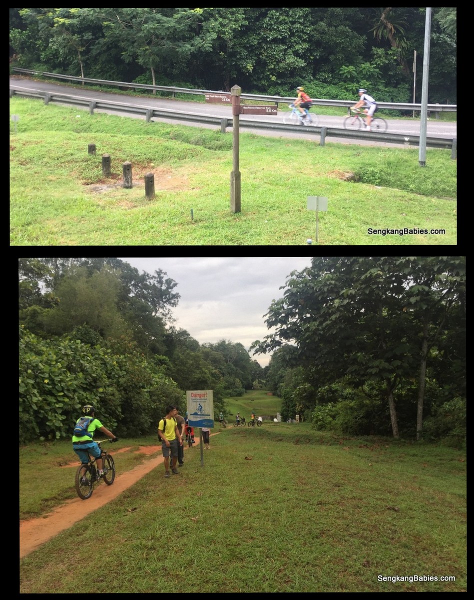
Have seen the pipes in Instagram, could not resist a selfie. Mountain bikers were happily chasing the contours and trenches.
water-pipes-bukit-timah-nature-reserve


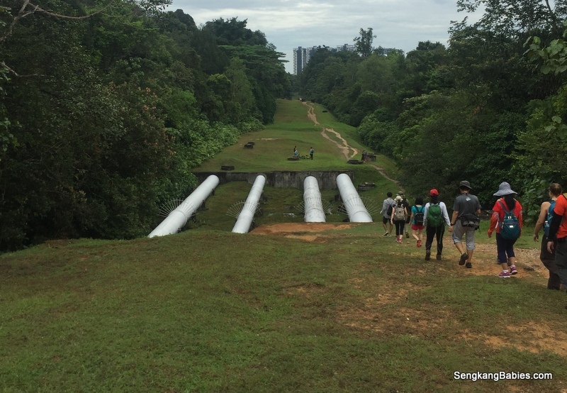
GPS for pipes estimation 1.352517, 103.784233
img_0072

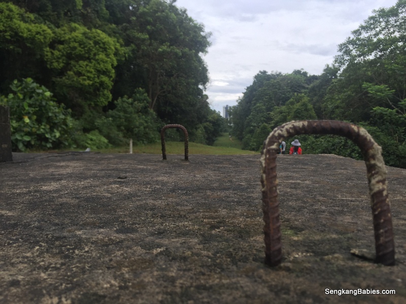
.. but PUB and Nparks (signage) always emphasized safety-first hee hee.
20161016-trail-durian-chestnut10

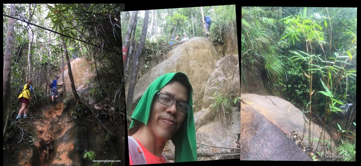
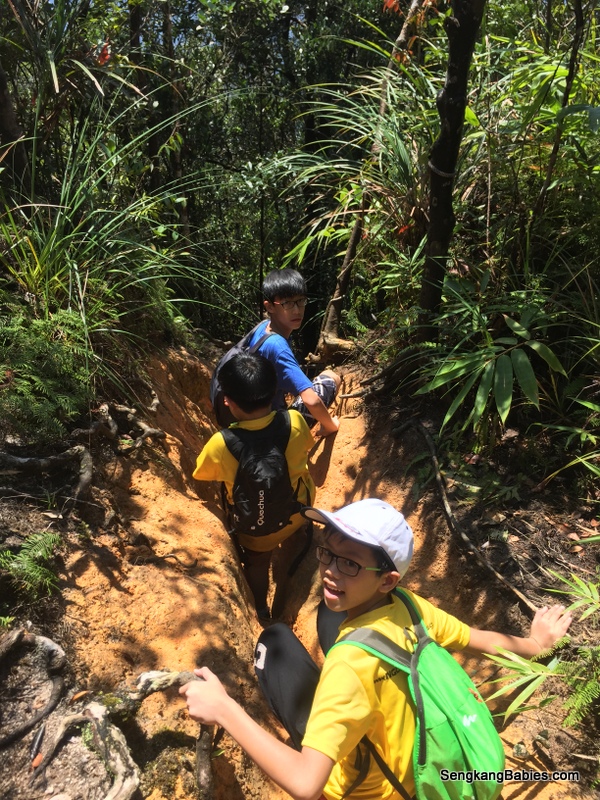
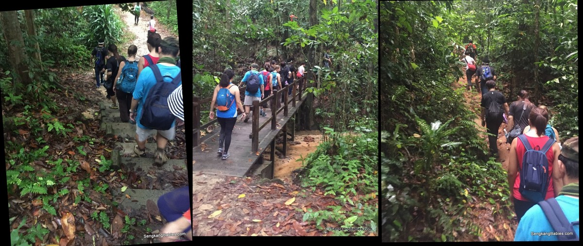
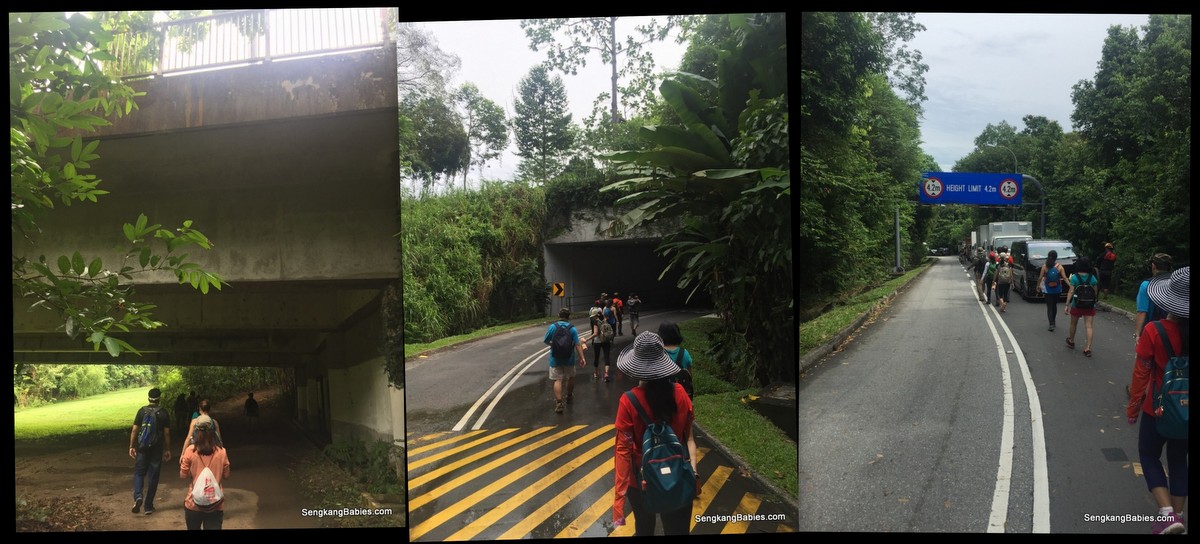
Along the trail, we walked under expressways, short bridges and along narrow slopes. It was a wonderful feeling to feel LOST in Singapore 🙂
20161016-trail-durian-chestnut17

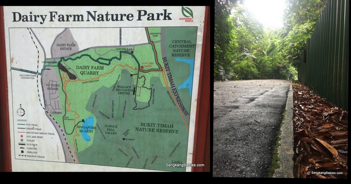
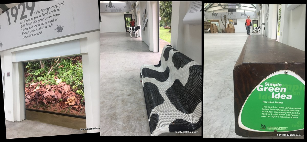
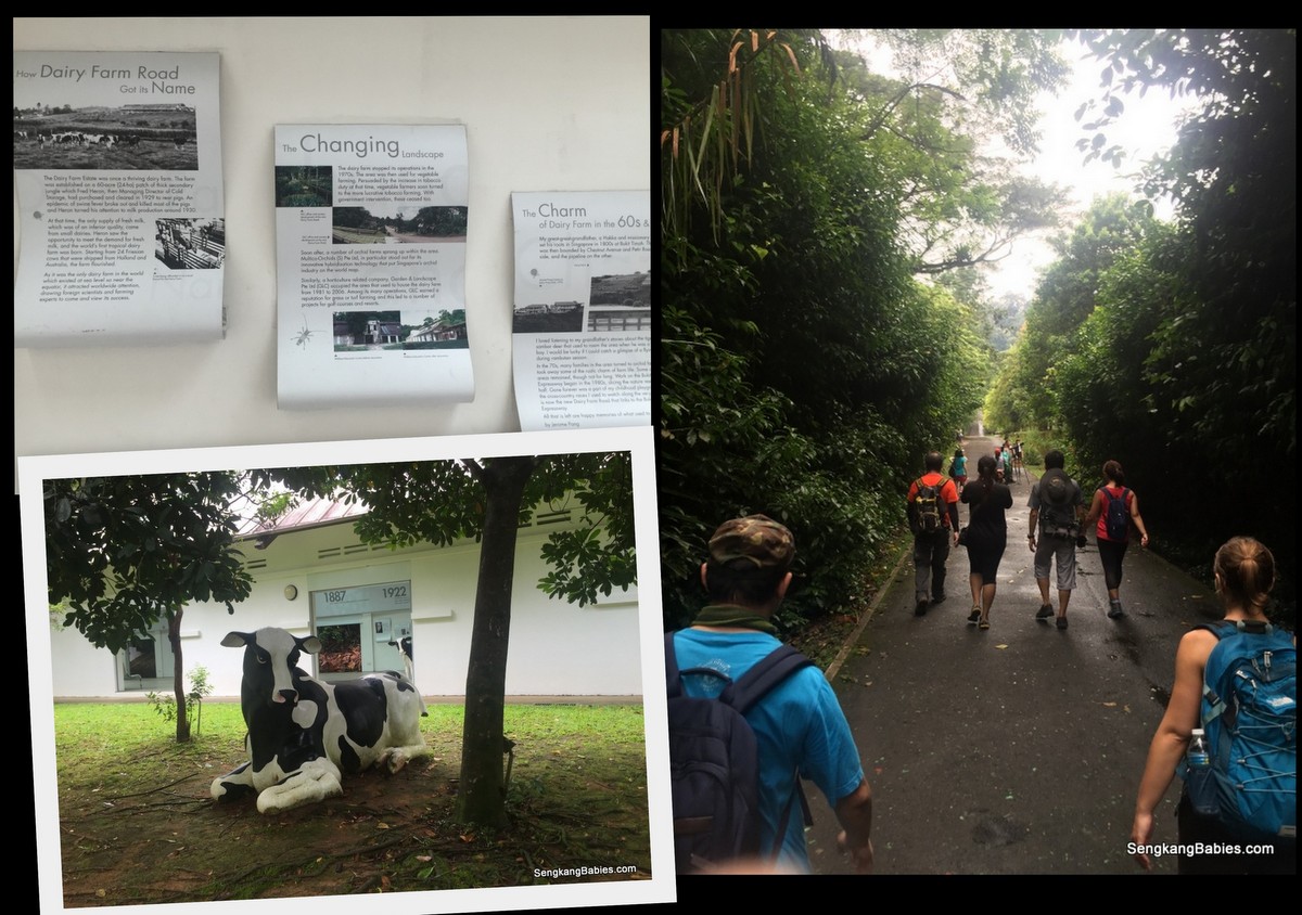
We pop by Dairy Farm Nature Park for toilet and water break. This park is ideal for family and it is less congested than Bukit Timah Hill.
20161016-trail-durian-chestnut13

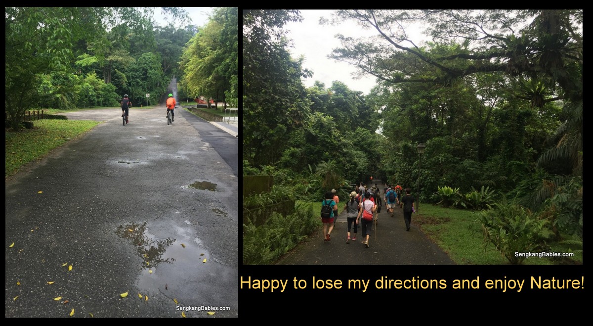
For once, it was pure bliss to enjoy the serene surroundings. I did not have to worry about navigating for family or finding the next water point.

Just enjoy the Greens, fresh air and scenery.
20161016-trail-durian-chestnut14
20161016-trail-durian-chestnut12

Hey, hiking in Singapore can be happening too!
20161016-trail-durian-chestnut11

We are never far from the main roads and motor sounds, that is how small Singapore is :p
20161016-trail-durian-chestnut15

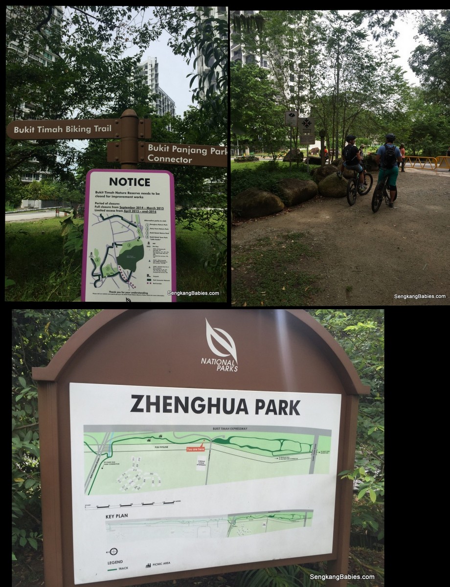
We linked up with Zhenghua Park.
20161016-trail-durian-chestnut16

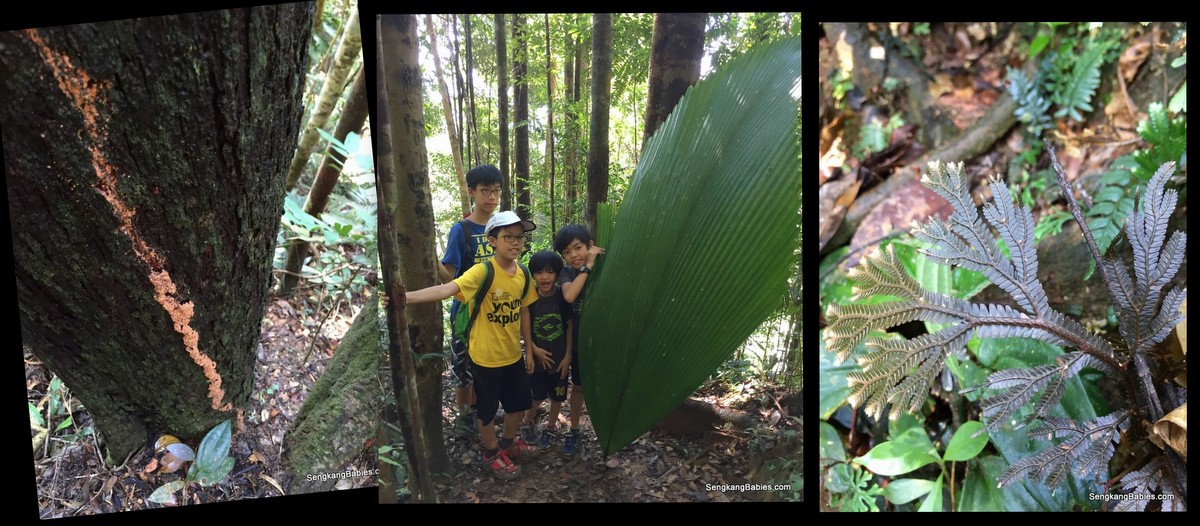
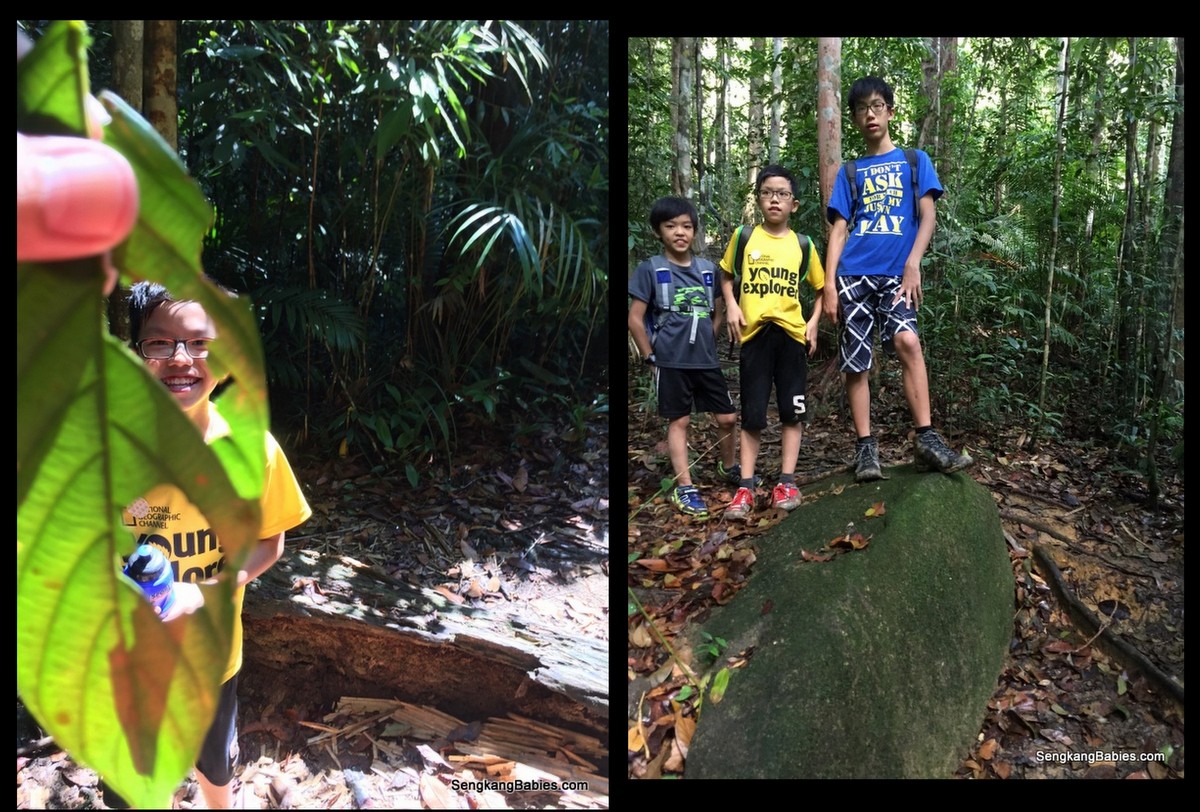
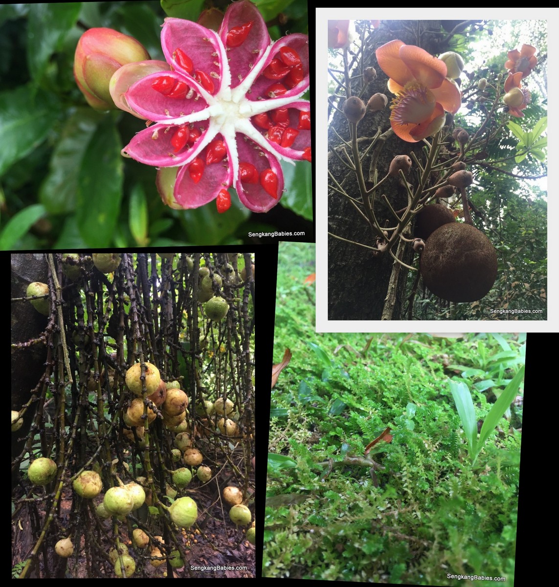
Part of the hiking or treking fun is to explore our surroundings, observe the flora and fauna. We do not get to see this plants or flowers everyday. I am not sure whether they are edible, just follow the birds, monkeys and squirrels.
20161016-trail-durian-chestnut9

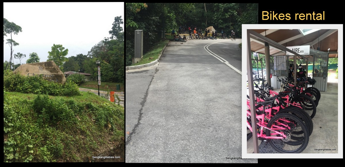
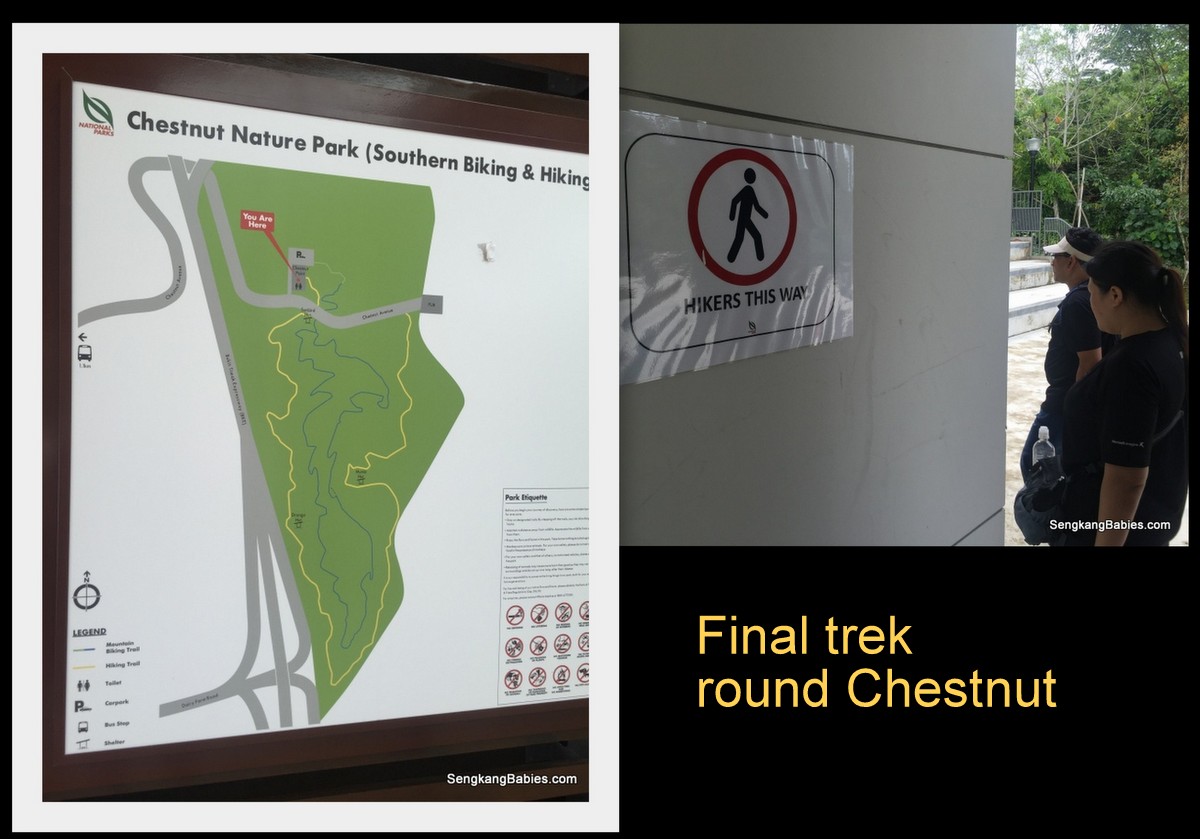
Follow Chestnut Avenue (slopes warning) to reach Chestnut Nature Park (South). Many Mountain Bikes use Chestnut Nature Park as a pitstop.
20161016-trail-durian-chestnut18

Chestnut Nature Park (North) is still under construction, we can look forward to more hiking and cycling trails.
20161016-trail-durian-chestnut19

Chestnut Nature Park sights. I only know roasted chestnuts (Gao3 Luc4) are delicious, have not seen the real chestnut yet.
chestnut-nature-park-photos

Interesting is an understatement for our trail this morning. Have you counted how many parks and trails we walk across 🙂

There is a sense of satisfaction, perhaps to pander to my craving for hikes. Although the adrenaline is not as high as Gunungs, but you still feel good.
My boys (girl maybe) would definitely be keen to follow me down this trail again.

More tips :
– Follow Singapore Adventure Nature Lover (SANL) group (and Facebook) to book your next Fun adventure (some activities are free)
– Follow Nparks for more hiking and trails recommendations
– Be careful bike and hiking trail differences, children should not wander onto bike paths
– Leave the pokemons catching to the urban areas, pay attention to the path ahead

More photos have been uploaded on our Fanpage album.
hiking-singapore-photos

Pop by our hiking adventures here –> https://sengkangbabies.com/tag/hiking

*note, photos above might not be in order

Hiking Gunung Belumut, our first 1000m summit

Love the morning Sun rays when we were Hiking Gunung Belumut! It was also how my heart was fluttering at the thought of another hike. Gunung Belumut is our first 1000m mountain 🙂
IMG_6341

Before this, our highest peak is Gunung Panti.

The numbers for Belumut.
4hours up, 3hours down.
15km to and fro, with the peak at 1100m.
To make it more challenging, rain fell 3 times!

We left home at 0445 and reach our breakfast venue at Kluang Rail coffee (GPS 2.033543, 103.317584). It is a real train station famous for coffee and toast (Opens at 0700).
20160716 Gunung Belumut

Nasi lemak (and Mee siam) only cost RM0.90 sen each! And there is only chili and white rice but the chili is solid! We suspect train passengers will buy these fantastic food for their meals.
20160716 Gunung Belumut1

A half an hour drive away, we reach the base of Gunung Belumut (GPS 02.06715 103.52507).

From a distance, we can see Kluang is surrounded by mountains. Mist constantly floats down to cover the road, heightening our anticipation.
Gunung Belumut GPS

Make shift carpark among the palm oil plantation.
IMG_6329

Hiking can be a good analogy for Parenting, or rather what I wish my kids to learn through Life.

Hiking can be dangerous, a single trip, slip or twist could mean fractures, sprains or even death. Like any sports, we need to exercise caution, take care of each other, anticipate dangers and be alert.

We need courage to step out of our comfort zone, and that’s when we learn more about ourselves.

I always tell them. Death comes to everyone and there is nothing to fear (or feel morbid). If our time is up, even crossing the road can be dangerous.

Life is really short (how many 20 years do we have), and our human body is so fragile. I only hope we will have minimum regrets at the very end 🙂
Gunung Belumut hike

The “Before” photo, all eager to hike Gunung Belumut.
Starting bridge and pond, make us wish to dip inside the cooling water.
20160716 Gunung Belumut4

From the beginning, a lot of fallen trucks lay in our path and we need to go under or over. Taller guys will need to constantly bend down under the trunks, I lost count of how many times my backpack stuck the ‘tree trunk belly’.
Gunung Belumut checkpoints

The map call Gunung Belumut a “recreational” forest, but we were sweating buckets and we had to climb on all fours at times.
It is always refreshing to reach the next “flat” ground.

Catch up with our breathe and water parade in preparation for the next slope.

20160716 Gunung Belumut7

Besides the hike, we need to enjoy the surroundings too. Termites trail, and a huge leaf (to wrap Nasi Lemak haha)
20160716 Gunung Belumut12

Pear-shape tree, ferns and mushrooms. The root on the right looks like a hammock.
20160716 Gunung Belumut16

Checkpoint 1 (around 3.3km mark). It was uphill up 60 degree gradient for the next 600m!
20160716 Gunung Belumut6

Kids helping each other over the obstacles, or finding an easier path to climb. Sometimes, I purposely keep quiet and let them figure out the next step or ‘rope’.

Kids are always tougher than we give them credit for 🙂
Gunung Belumut review

Sense of achievement? Perhaps, but they do treasure the companionship and jokes along the way.
20160716 Gunung Belumut13

Checkpoint 2 (around 4.6km), some weird rock formation here. Looks like a walled fortress or a stage 🙂
(Checkpoint 1 to 2 is only 1.3km, but steep terrain means we need 50 minutes to reach CP2)
IMG_6413

Face towel was useful to stop the perspiration and block some rain too.
IMG_6446

Our guide say this was the 80 degrees wall, we had to climb up by navigating in a zigzag manner, left to right to left again. Make use of the roots.
Gunung Belumut with children

It lead us to a rock face, and we need to skirt behind and up.
Gunung Belumut experience

The rain started falling after checkpoint 2, and we were caught in 3 downpours! Besides the slippery and muddy slope, our pants and underwear were all soaked.

Checkpoint 3 is around 5.6km mark, I did not see the sign or landmark.

Hike higher, and you will see moss-covered branches and rocks. I was looking forward to some moss carpet, common in higher altitude.
20160716 Gunung Belumut10

A fake summit (around 8km mark), the real summit is 20 minutes more to the left 🙂
Gunung Belumut fake summit

Finally the summit. But Gunung Belumut summit view is actually not spectacular and it was crowded.
Gunung Belumut height

We completed the hike in 4 hours plus. I was so excited that I forgot to sing Boon Kang a Birthday song haha. I had plan this hike as an advance Birthday gift for him 🙂 (We did sing a short rendition on the way down, see video below)
Gunung Belumut with family

We u-turn to have our mini lunch at the barren “fake” summit.
Our hiking brunch and lunch include :
– x4 1.5l water
– x3 100plus
– x6 banana
– x4 bread, baked beans and tuna (do not bring pork up hills and mountain in case we offend some spirits)
– x6 butter biscuits
– x4 sandwich

It was a heavy load to bear for up to 5 hours! We start our descend at around 2pm.
IMG_6526

There are a lot of “drains” to wade across. They become mini waterfalls when the rain fell. As we climb lower, it became darker and we were glad to exit at around 1730.

Although we were slightly behind time, it was crucial that we be extra vigilant and watch our steps. Kept reminding the kids that we might get careless when we are tired, and a slip would only make the situation worse.
IMG_6535

Hiking is a good way to bond and see the kids’ characters. We must help each other, motivate and encourage the weaker ones.
I would rotate the “leaders” so that everyone has a chance to lead and identify the markers ahead.

Kids would volunteer to share the load around so that no one is overly stretched. Hiking is a team effort and we need to reach the summit together.

Most importantly, always remember to have Fun!
We hope Mommy and princess can join us soon 🙂
IMG_6241

Video (link) : Photos cannot capture the kids’ persistence to conquer Hiking Gunung Belumut

Proceeded to checkin at our hotel for the night at Rail Hotel (GPS 2.023473, 103.311938 ). I was worried that legs will be too numbed to drive back to Singapore :p
Rail hotel Kluang

King sized bed for RM150, including breakfast voucher of RM24. Recharge before driving home the next day. I knock off at 10pm while the kids were still playing games.

From the map below, Gunung Belumut is between UK Farm and Koref.
Kluang surroundings

Do your staircase training before attempting Gunung Belumut, my calves are still straining after two days.
If you are first time hiking, go for the 500m (or below) Johor mountains first (Panti, Arong, Pulai, Lambak). All are within 2 to 2.5 hours rive from Singapore, and a good start for children. In Singapore, Bukit Timah Hill (163m) and MacRitchie Tree Top walk would be a nice warm up. (Panti is 3 times harder than Bukit Timah, and I felt Belumut is easily 2 to 3 times harder than Panti)

Our hike was made possible with Facebook group “Freewill Hikers“. Guides and permit are needed for hiking Gunung Belumut (For our group of 45, we need to pay RM 40 per head).
We first hike up Gunung Panti (500m) with Free Hikers too, do join their group for future events.

More hiking photos uploaded on our Fanpage album.
Read all our hiking stories here.

ps.. Follow our Instagram tag #SengkangBabiesJohor for more JB adventures