Hiking Gunung Belumut, our first 1000m summit

Love the morning Sun rays when we were Hiking Gunung Belumut! It was also how my heart was fluttering at the thought of another hike. Gunung Belumut is our first 1000m mountain 🙂
IMG_6341

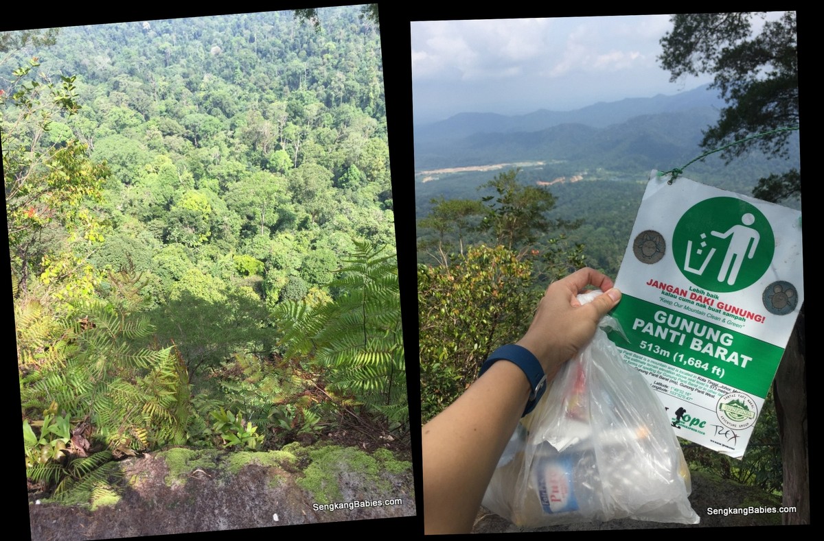
Before this, our highest peak is Gunung Panti.

The numbers for Belumut.
4hours up, 3hours down.
15km to and fro, with the peak at 1100m.
To make it more challenging, rain fell 3 times!

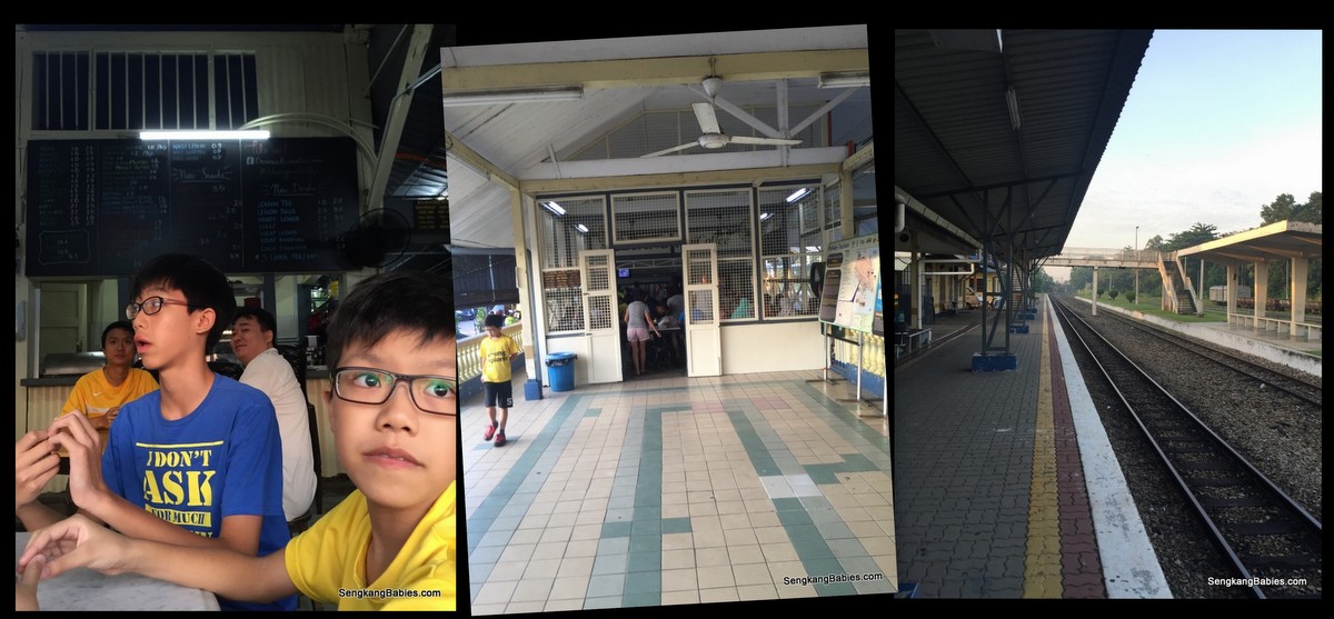
We left home at 0445 and reach our breakfast venue at Kluang Rail coffee (GPS 2.033543, 103.317584). It is a real train station famous for coffee and toast (Opens at 0700).
20160716 Gunung Belumut

Nasi lemak (and Mee siam) only cost RM0.90 sen each! And there is only chili and white rice but the chili is solid! We suspect train passengers will buy these fantastic food for their meals.
20160716 Gunung Belumut1

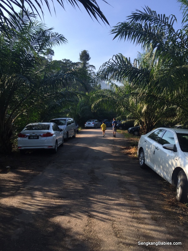
A half an hour drive away, we reach the base of Gunung Belumut (GPS 02.06715 103.52507).

From a distance, we can see Kluang is surrounded by mountains. Mist constantly floats down to cover the road, heightening our anticipation.
Gunung Belumut GPS

Make shift carpark among the palm oil plantation.
IMG_6329

Hiking can be a good analogy for Parenting, or rather what I wish my kids to learn through Life.

Hiking can be dangerous, a single trip, slip or twist could mean fractures, sprains or even death. Like any sports, we need to exercise caution, take care of each other, anticipate dangers and be alert.

We need courage to step out of our comfort zone, and that’s when we learn more about ourselves.

I always tell them. Death comes to everyone and there is nothing to fear (or feel morbid). If our time is up, even crossing the road can be dangerous.

Life is really short (how many 20 years do we have), and our human body is so fragile. I only hope we will have minimum regrets at the very end 🙂
Gunung Belumut hike

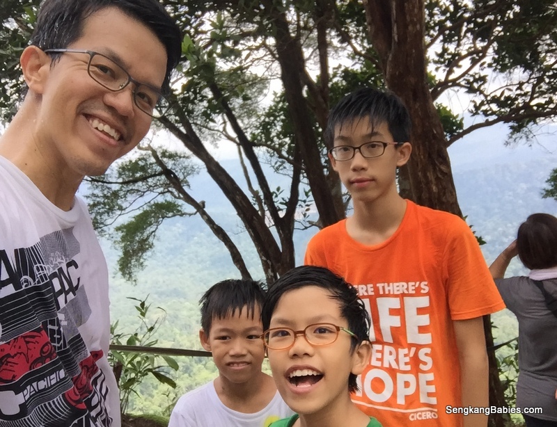
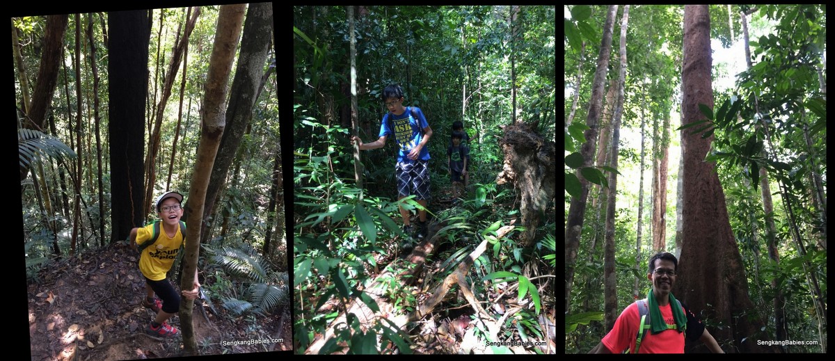
The “Before” photo, all eager to hike Gunung Belumut.
Starting bridge and pond, make us wish to dip inside the cooling water.
20160716 Gunung Belumut4

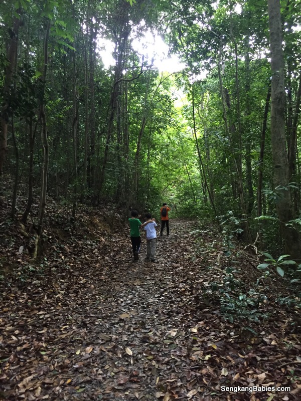
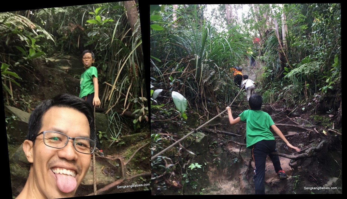
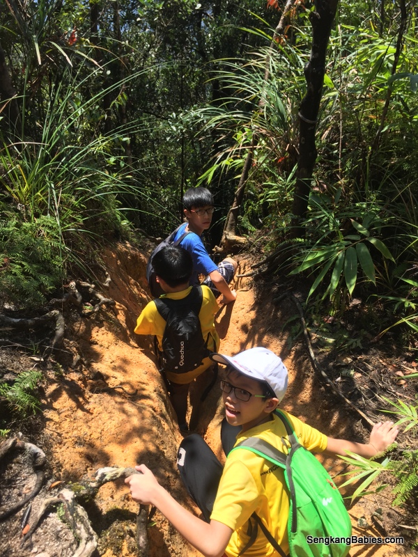
From the beginning, a lot of fallen trucks lay in our path and we need to go under or over. Taller guys will need to constantly bend down under the trunks, I lost count of how many times my backpack stuck the ‘tree trunk belly’.
Gunung Belumut checkpoints

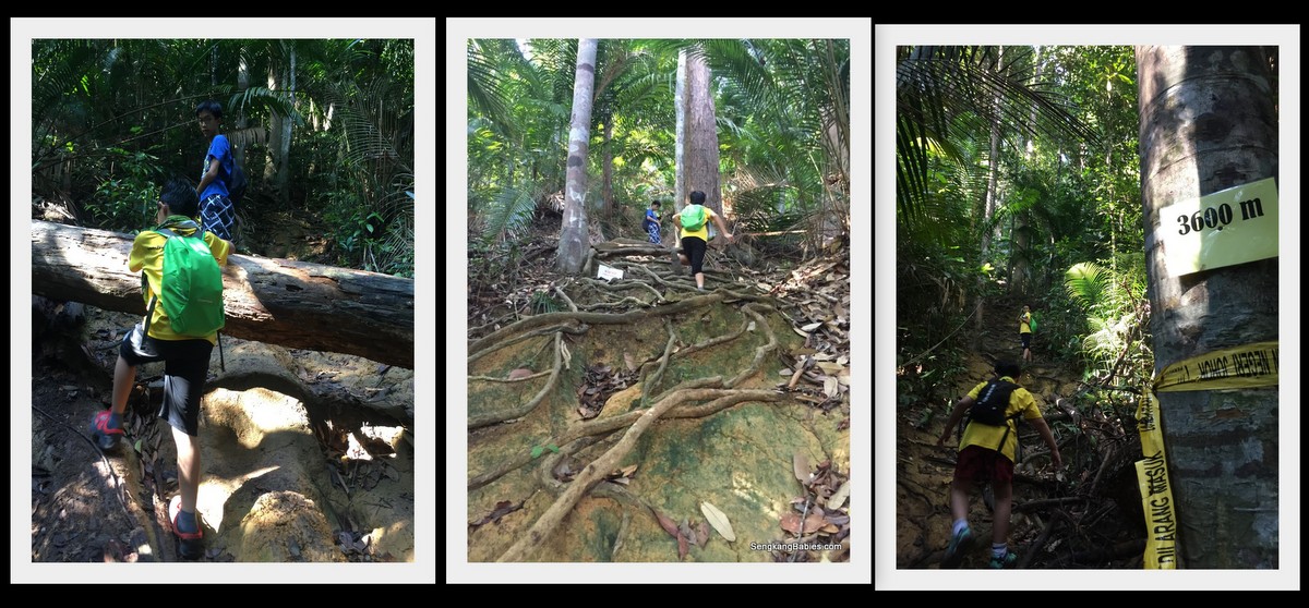
The map call Gunung Belumut a “recreational” forest, but we were sweating buckets and we had to climb on all fours at times.
It is always refreshing to reach the next “flat” ground.

Catch up with our breathe and water parade in preparation for the next slope.

20160716 Gunung Belumut7

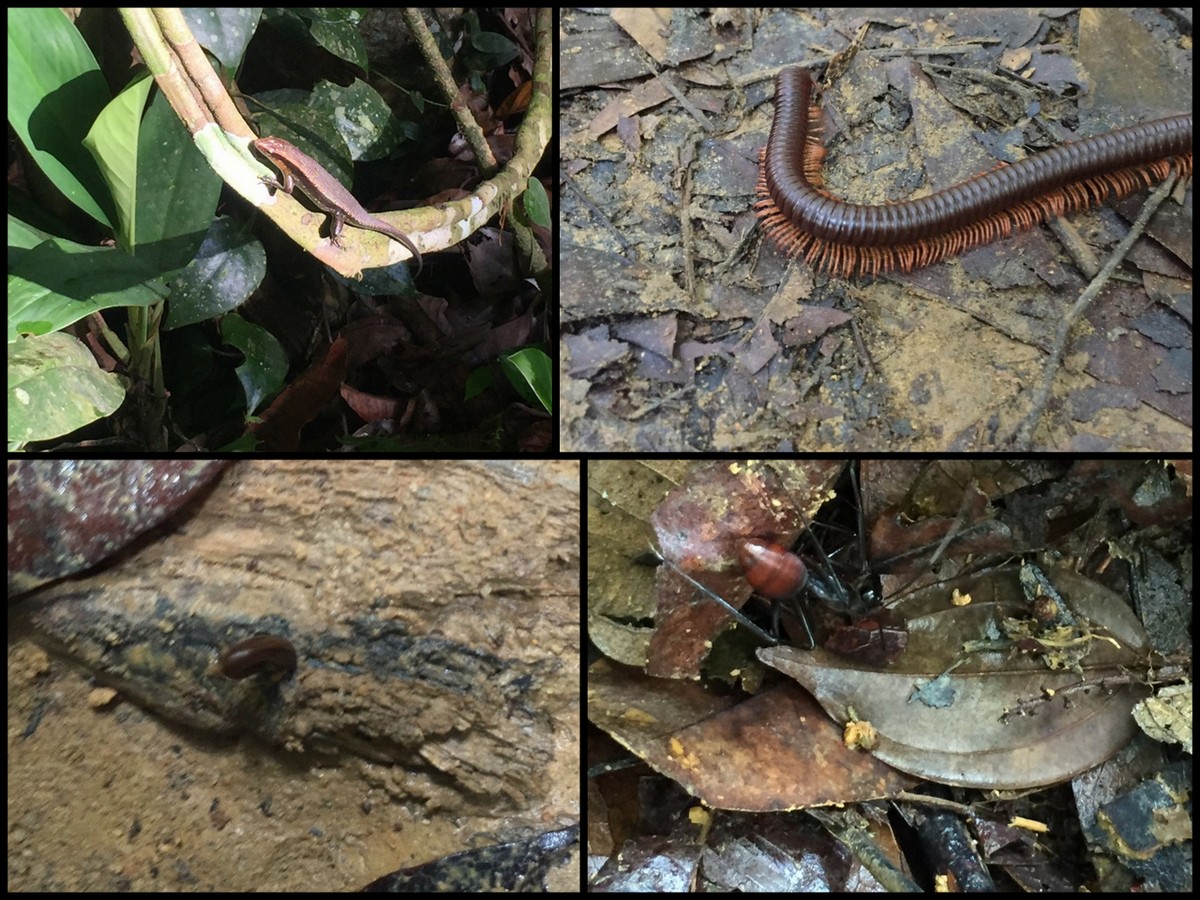
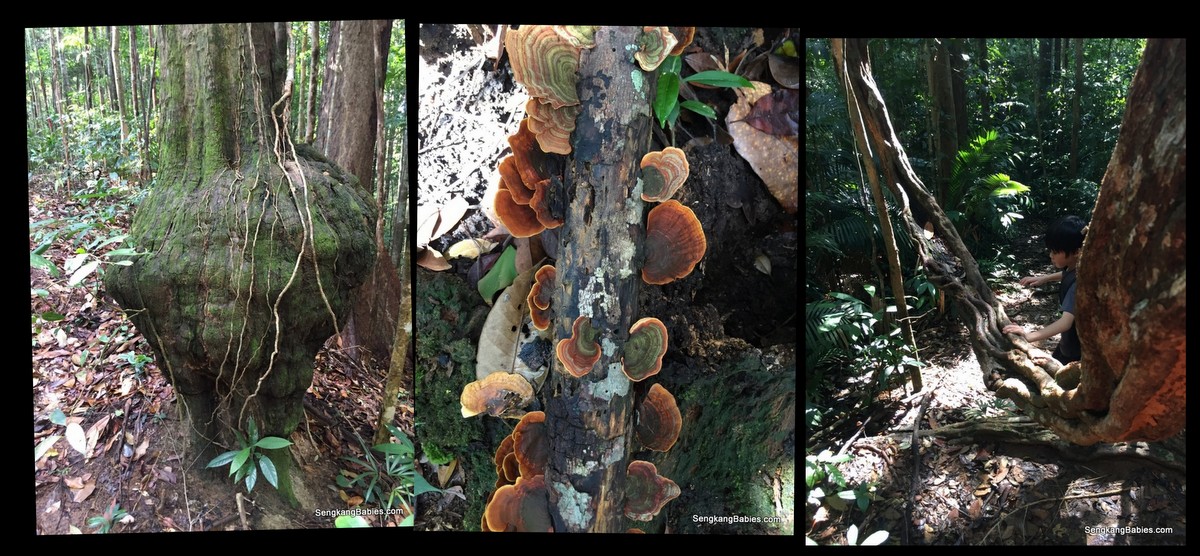
Besides the hike, we need to enjoy the surroundings too. Termites trail, and a huge leaf (to wrap Nasi Lemak haha)
20160716 Gunung Belumut12

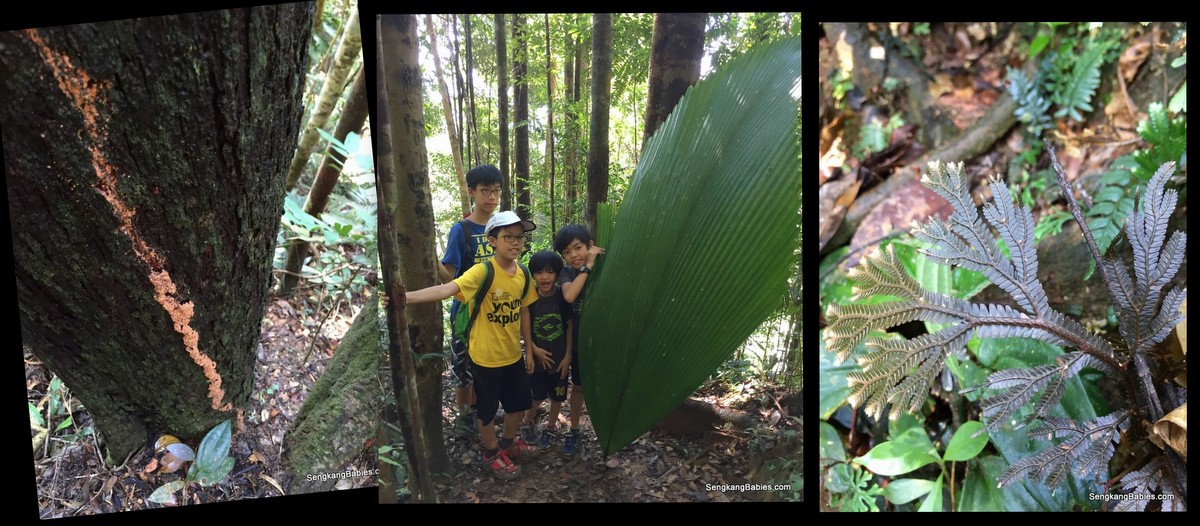
Pear-shape tree, ferns and mushrooms. The root on the right looks like a hammock.
20160716 Gunung Belumut16

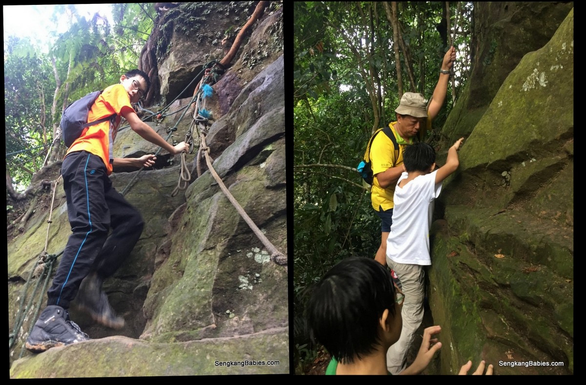
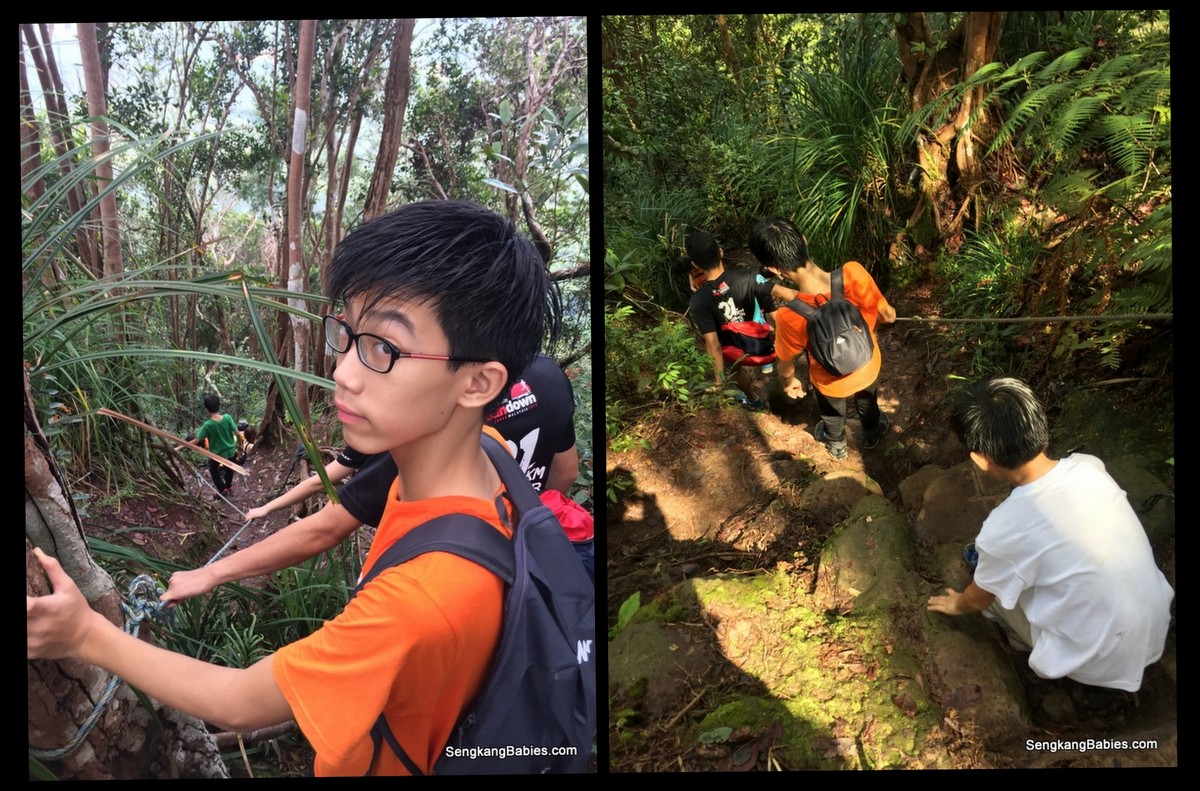
Checkpoint 1 (around 3.3km mark). It was uphill up 60 degree gradient for the next 600m!
20160716 Gunung Belumut6

Kids helping each other over the obstacles, or finding an easier path to climb. Sometimes, I purposely keep quiet and let them figure out the next step or ‘rope’.

Kids are always tougher than we give them credit for 🙂
Gunung Belumut review

Sense of achievement? Perhaps, but they do treasure the companionship and jokes along the way.
20160716 Gunung Belumut13

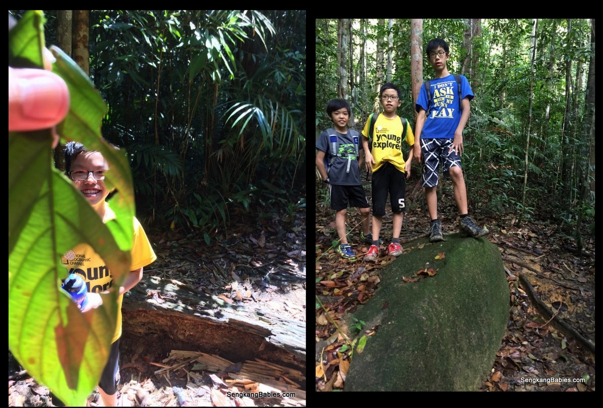
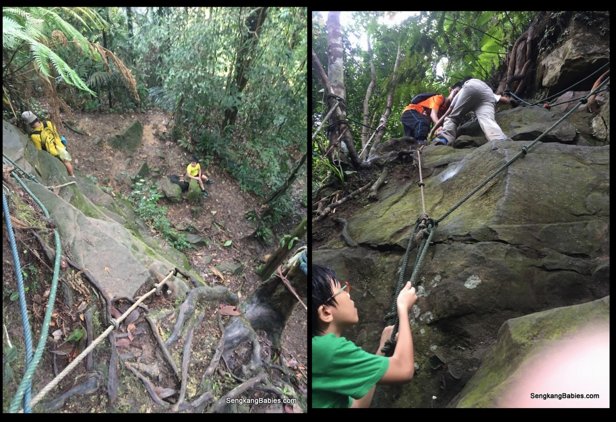
Checkpoint 2 (around 4.6km), some weird rock formation here. Looks like a walled fortress or a stage 🙂
(Checkpoint 1 to 2 is only 1.3km, but steep terrain means we need 50 minutes to reach CP2)
IMG_6413

Face towel was useful to stop the perspiration and block some rain too.
IMG_6446

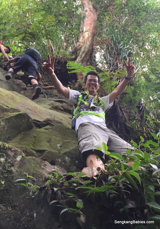
Our guide say this was the 80 degrees wall, we had to climb up by navigating in a zigzag manner, left to right to left again. Make use of the roots.
Gunung Belumut with children

It lead us to a rock face, and we need to skirt behind and up.
Gunung Belumut experience

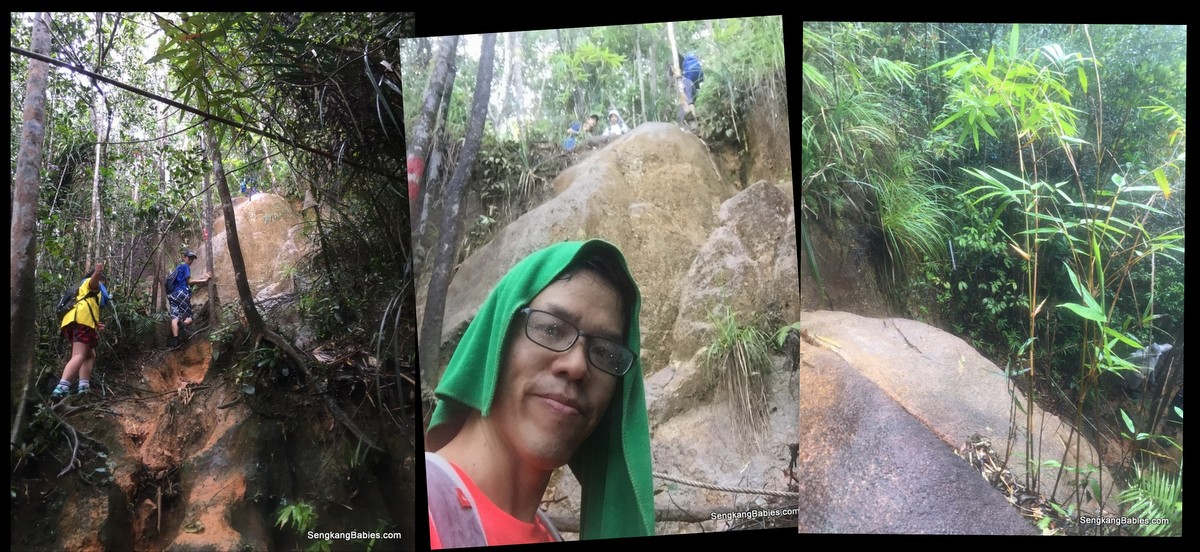
The rain started falling after checkpoint 2, and we were caught in 3 downpours! Besides the slippery and muddy slope, our pants and underwear were all soaked.

Checkpoint 3 is around 5.6km mark, I did not see the sign or landmark.

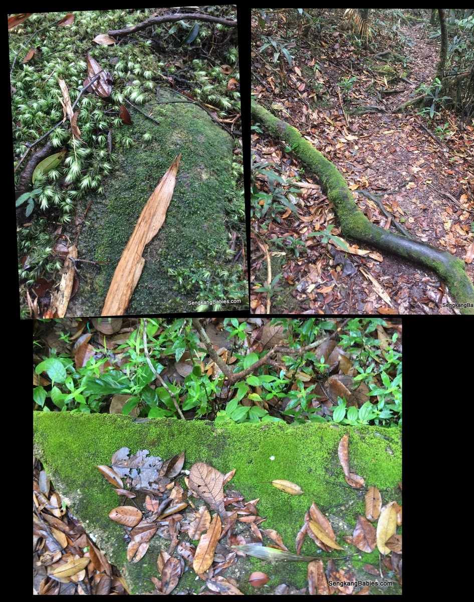
Hike higher, and you will see moss-covered branches and rocks. I was looking forward to some moss carpet, common in higher altitude.
20160716 Gunung Belumut10

A fake summit (around 8km mark), the real summit is 20 minutes more to the left 🙂
Gunung Belumut fake summit

Finally the summit. But Gunung Belumut summit view is actually not spectacular and it was crowded.
Gunung Belumut height

We completed the hike in 4 hours plus. I was so excited that I forgot to sing Boon Kang a Birthday song haha. I had plan this hike as an advance Birthday gift for him 🙂 (We did sing a short rendition on the way down, see video below)
Gunung Belumut with family

We u-turn to have our mini lunch at the barren “fake” summit.
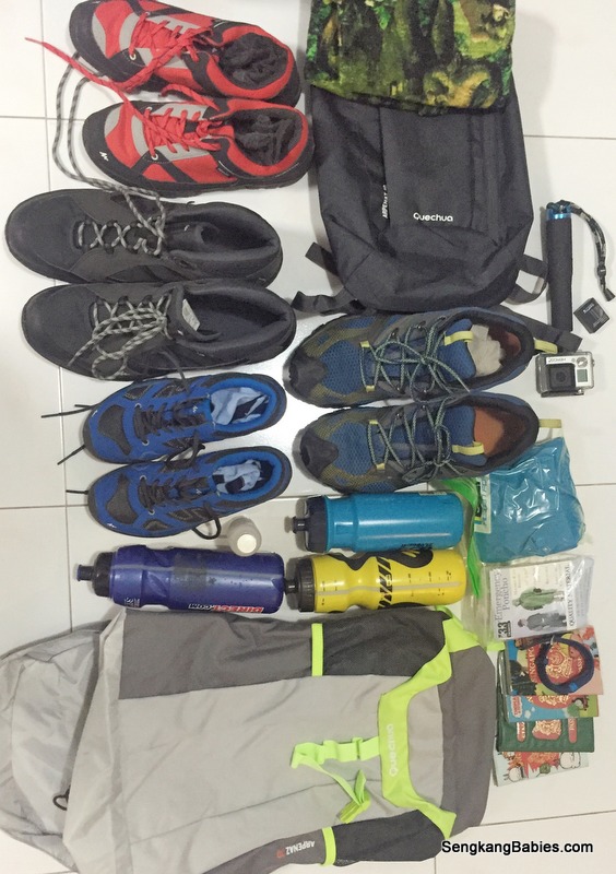
Our hiking brunch and lunch include :
– x4 1.5l water
– x3 100plus
– x6 banana
– x4 bread, baked beans and tuna (do not bring pork up hills and mountain in case we offend some spirits)
– x6 butter biscuits
– x4 sandwich

It was a heavy load to bear for up to 5 hours! We start our descend at around 2pm.
IMG_6526

There are a lot of “drains” to wade across. They become mini waterfalls when the rain fell. As we climb lower, it became darker and we were glad to exit at around 1730.

Although we were slightly behind time, it was crucial that we be extra vigilant and watch our steps. Kept reminding the kids that we might get careless when we are tired, and a slip would only make the situation worse.
IMG_6535

Hiking is a good way to bond and see the kids’ characters. We must help each other, motivate and encourage the weaker ones.
I would rotate the “leaders” so that everyone has a chance to lead and identify the markers ahead.

Kids would volunteer to share the load around so that no one is overly stretched. Hiking is a team effort and we need to reach the summit together.

Most importantly, always remember to have Fun!
We hope Mommy and princess can join us soon 🙂
IMG_6241

Video (link) : Photos cannot capture the kids’ persistence to conquer Hiking Gunung Belumut

Proceeded to checkin at our hotel for the night at Rail Hotel (GPS 2.023473, 103.311938 ). I was worried that legs will be too numbed to drive back to Singapore :p
Rail hotel Kluang

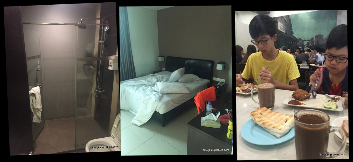
King sized bed for RM150, including breakfast voucher of RM24. Recharge before driving home the next day. I knock off at 10pm while the kids were still playing games.

From the map below, Gunung Belumut is between UK Farm and Koref.
Kluang surroundings

Do your staircase training before attempting Gunung Belumut, my calves are still straining after two days.
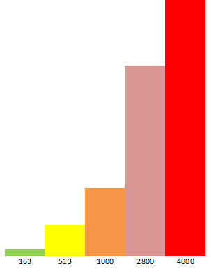
If you are first time hiking, go for the 500m (or below) Johor mountains first (Panti, Arong, Pulai, Lambak). All are within 2 to 2.5 hours rive from Singapore, and a good start for children. In Singapore, Bukit Timah Hill (163m) and MacRitchie Tree Top walk would be a nice warm up. (Panti is 3 times harder than Bukit Timah, and I felt Belumut is easily 2 to 3 times harder than Panti)

Our hike was made possible with Facebook group “Freewill Hikers“. Guides and permit are needed for hiking Gunung Belumut (For our group of 45, we need to pay RM 40 per head).
We first hike up Gunung Panti (500m) with Free Hikers too, do join their group for future events.

More hiking photos uploaded on our Fanpage album.
Read all our hiking stories here.

ps.. Follow our Instagram tag #SengkangBabiesJohor for more JB adventures

Gunung Panti hike 2016, and one proud Daddy

We did it! We hiked up Gunung Panti with the boys recently. Rated “simple to moderate”, this hill near to Kota Tinngi waterfall is 513m and will take 5 hours round trip. In contrast, Singapore’s tallest hill is Bukit Timah, read our 163m review here.

This milestone will lead us to many more summits!

More than the climb, more than the view, this hike made me super PROUD to be their Dad! It is not an easy climb but their resilience and attitude impressed me. We parents always underestimate the kids’ resolve and determination.

Gunung Panti family

(Photo below) The trail starts on the right, there is a small path and we have added “estimated” GPS below.

Three minutes into our hike, we need to cross a stream and our socks and shoes turn soggy yucks! But once kids are conditioned that hiking is sweaty and dirty, it is so much easier to march forward and upwards :p

Take note we had started on the wrong path, otherwise we would have crossed the “Monkey bridge”.
20160612 hike Gunung Panti2

We were supposed to link up with our volunteer guides from “Freewill Hikers’ Club“, but we park at the wrong corner. After asking around, we decided to follow the trail up the hill.

In the spirit of adventure (actually, we did not want to return empty-handed haha), we decided to do some DIY venturing. We followed a guide and his guests some of the way, and the local police who were practicing near the hills helped too. They must be wondering why this Dad is bringing three boys up the hills alone haha.

HIKING is a bit of Unknown, a bit of Adventure right :p

We try to spot the next ribbon and marking as we hike deeper. We would not recommend diy hiking, as it is easy to get lost as there are a few junctions along the way. When we are tired, anxious (or even dehydrated), we can easily lose our sense of direction.
20160612 hike Gunung Panti3

Use our hands to feel, grab the branches to balance, give each other a helping hand. It is important to let kids understand that hiking is not walk-in-the-park 🙂

Uneven slopes, muddy floors, thick under-growths, mosquitos for companions. More than the physical climb, our mind is always scanning the path infront to avoid tripping or slipping. The roots and fallen leaves are especially slippery.

I need to constantly remind the kids to go easy on the jumping (Take care of your knees!)
20160612 hike Gunung Panti5

HELLO Hiking, kids are in good spirits!
20160612 hike Gunung Panti6

Rainforest Exploration

Huge tree trunks, some are so thick we need to skirt around.
Gunung Panti photos

Flora, some plants are interesting, moss or the star shaped flower.
20160612 hike Gunung Panti1

Rich Fauna too. The millipede is 15cm (long!) and the Upsized ants look menacing! But the most eerie creature must be the blood-sucking leech (our video shows it trying desperately trying to latch onto us!)
20160612 hike Gunung Panti

Savour the moment, the nature and strive forward. The crickets and symphony greeted us along the corridors.
I purposely rotate the “leader” so everyone had a chance to navigate and lead our team, perhaps this will give them a sense of mission?
Gunung Panti

One hour into our hike, we found our guide Richard and his grandson Rain. I was really relieved that we were on the correct path all along.

Further up, we were fortunate to meet Gunung Panti’s guardian Angel too, 小黑 (Little Black).
20160612 hike Gunung Panti14

Never give up, Just do it!

The last 50m is a 90 degrees rock wall!

Step by step, we slowly find our grip (and grit) and inch upwards. A sense of liberty and freedom as we try to defy gravity. Richard guided us where to place our balance.
20160612 hike Gunung Panti7

Oh, it helps if you do not look down! As long as we hug the wall, we are safe.
20160612 hike Gunung Panti8

Although tired, we must always motivate each other 🙂
20160612 hike Gunung Panti9

Our hair was never dry once we started, 2.5 hours UP and 2 hours down.
IMG_3568

Summit view,Boon Kang counting the number of Gunungs across the horizon.
20160612 hike Gunung Panti11

Group photo at the top, friendly folks who help each other 🙂
13419263_10208355019466482_7408501926979793567_n
(Image credit Freewill Hikers)

Video (link) : Our virgin hiking experience

Please remember to bring your thrash down.
20160612 hike Gunung Panti10

After enjoying the fresh air, time to go down. We move gingerly down the steep wall, going down is harder than going up 🙂
Gunung Pantisummit

Boon Yee and Boon Wee managing a smile. Halfway down, they unanimously say “YES” when I ask them whether they wish to attempt another hill.

As their Dad, I was beaming with PRIDE.
Gunung Panti with kids

Fast forward to the end point, we can use Monkey bridge or sandbags to cross the stream. Adventures all the way 🙂
20160612 hike Gunung Panti13

We started and end our hike in wet conditions. When we started, we had missed the monkey bridge and waded in ankle-deep water. At the end point, the torrential downpour was refreshing and washed away our fatigue 🙂
20160612 hike Gunung Panti15

Introducing our hiking gear:
– Decathlon Quechua hiking shoes for the kids, from $17 onwards. Cheap and good!
– We had a 10L $3.90 bagpack (yes so cheap!!) for some snacks
– I got a 30L backback for the water
– Poncho
– I brought some salt-water for the leeches too (not sure whether effective)

Hiking shoes are a must, those wearing running shoes kept slipping.
deacthlon hiking shoes

This is my first hike in Johor too, glad the kids could accompany me. This climb would not be possible without the friendly “Freewill Hikers’ Club“. Subscribe to them and start charting more adventures ahead 🙂

The best way to train for Gunung Panti is combining Bukit Timah Hill (steepness) and MacRitchie Tree Top walk (distance and endurance)

We can start to look forward to more challenging hikes. From (L to R), hills in comparison. Bukit Timah, Panti, Ophir, Ijen, and Mount K :p
hill mountain peaks height

More tips about Gunung Panti and hiking with kids:

– Gunung is Malay for Mountain, and Gunung Panti’s Chinese name is 猪头山 (literally Pig Head!)
– Gunung Panti GPS “1.808107, 103.845048“, entrance to trail is next to Rainforest Resort.
– Hikers normally park along the main road, some will drive further into the small roads

– Climb to rock wall is 2 hours, add 30 mins to rope up last 50 metres
– My Fitbit signal was unstable, as a conservative estimate, we trek 15km and 150 steps (two way)

– Long pants or bermudas? Richard recommended that bermudas might be better as long pants might conceal the leeches!

– Have ample rest to catch your breath and let body accustomed to heights. Kids, especially tend to overestimate their own fitness and like to dash from point to point

* It is very humid under the canopy, drink plenty of water

– Touch wood if we are lost, kids should follow stream downwards until they reach village or settlement. That will be our meeting point. (Please provide guidance for me if my understanding is wrong)

* You may wish to cool down at Kota Tinggi Waterfall, a short 5 min drive away

hiking Gunung Panti

Read all our hiking stories HERE, Kawah Ijen is recommended.
More photos have been uploaded on our Fanpage album. We hope more families will pick up hiking too.

Hiking is like parenting, we all have our summits to conquer, I am always telling the kids that although the end destination is nice, we must always remember to savour the journey.

To all the DADs out there, Happy Father’s Day 🙂

*updated Jul2016 – we submitted Gunung Belumut too (1000m)

ps.. Follow our Instagram tag #SengkangBabiesJohor for more JB adventures