Day 2 of Bikepacking 4 Rivers brought me through the heart of Seoul.
Take note that this is a detour from the main “Four Rivers” trail.
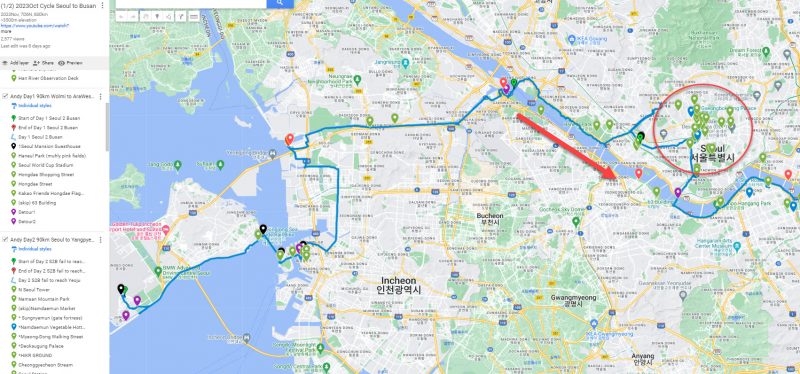
Refer custom Google Map‘s red icons for more clarity (or confusion :p )
~~~ 7D6N solo bikepacking itinerary~~~ ~~~ ~~~
Day1 90km IncheonAirport to AraWest to Hongdae
*Day2 90km Seoul to Yangpyeong
Day3 123km Yangpyeong to Suanbo
Day4 82km Suanbo to SangjuSi
Day5 90km SangjuSi to Daegu
Day6 114km Daegu to Namji
Day7 95km Namji to Busan
Refer picture below. I had purposely detoured because I wanted to explore some famous attractions in downtown Seoul on two wheels.
Kakao Map and Naver Map will likely ask you to cycle on BUSY pedestrian foot paths. And Seoul is packed with folks!
You are unlikely to cycle faster than 15kmh on the pavements.
If confident, go on the roads. But I have shared before that cyclists are not really welcomed by other road users.

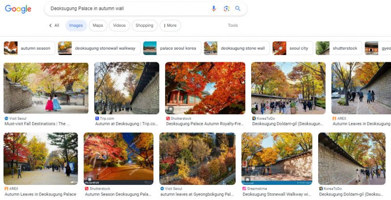
One of the external wall of this palace is famous for Autumn Foliage, but I went to the wrong wall! (facing police station).
Go to “GPS 37.564859, 126.975467” instead.
Famous Landmark at Gwanghwamun Square

King Sejong the Great landmark attraction
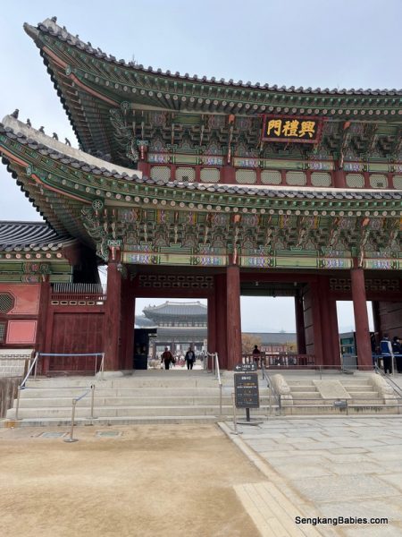
Gyeongbokgung Palace (경복궁) should be the most famous and elaborate palace in Seoul. You cannot cycle inside the Palace compound.

You can bring your bike around to the carpark behind (for tourist coaches), and walk through the other gate (Roughly GPS 37.576565, 126.978250).
Try to aim for the 1000 change-of-guard ceremony.
 Seoul attractions palaces

Quick breakfast before I head towards War Memorial. There are plenty of F&B options in Seoul. Beargels coffee set is slightly more expensive, at 11000 Won.
Folks will tell you that security in Seoul (and Korea) is good. Most cyclists will just leave their bicycles outside cafe or toilet unlocked. Trust the locals 🙂

Gate fortress “Sungnyemun 숭례문” is at a busy round-about intersection.

Cycled past Seoul Station (서울역) without realising. I just noticed the outstanding colonial style facade.
By now, you would notice that all “Korean” characters look very similar! This will be a headache when you try to “Kakao or Naver” nearby attractions, Motel or even F&B! It was hard for me to differentiate the characters.
(As a comparison, it is easier to differentiate between Japanese characters)


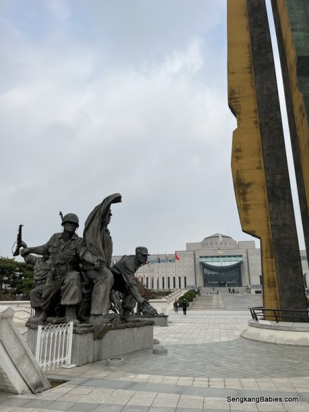


Although I might have detoured significantly from original Bikepacking 4 Rivers route, I enjoyed the sightseeing in downtown Seoul.
1)Go Easy with planning
I was a bit ambitious (greedy) and tried to covered too many attractions. This affected my itinerary and delayed my motel checkin in the evening.
Plan realistically and maybe conservatively. There are too many attractions and you will not have enough time or energy to cover all. Prioritise.
Fortunately, I skipped hiking 2 hours up “Inwangsan Mountain Park” or cycling up Seoul Tower (both offers elevated view of Seoul skyline). Take note that Seoul Tower slope is steep, and some segments are shared with coaches. (Be careful).
Both activities will require some amount of exertion and would definitely stretched my time.
These were NOT the most ambitious part of my planning! I was supposed to extend my bikepacking trip by five days and 500km. Taking a three-hour ferry from Busan to Fukuoka, before cycling North to Hiroshima and Shimanami Kaido (The most beautiful bike path in Japan). What was I thinking 🙂
Do pop by our Kyushu itinerary (九州) too. Kyushu is super underrated and we really enjoyed our family trip back in Jan 2023.

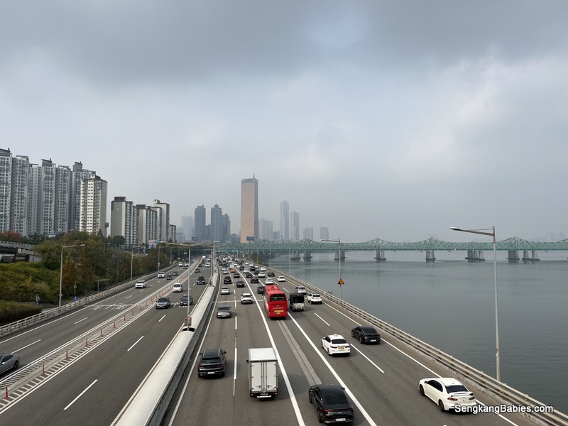
Refering to map below, after cycling across Han River, I turned East towards Yeoju direction. Due to thunderstorm, I was forced to stop at “X” Yangpyeong corner, which was 30km short.
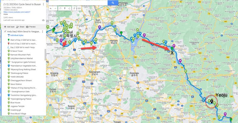 Korea four rivers map

2)Kakao Map tips
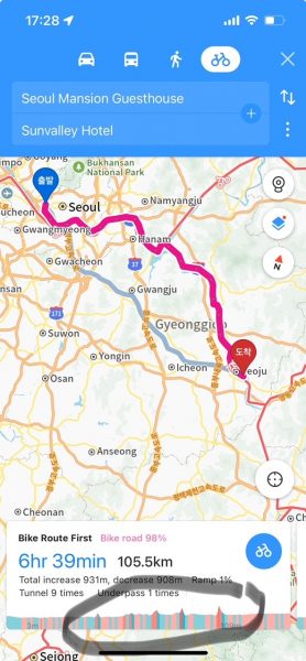
1) Choose “Bicycle option”, and you might noticed three “Coloured lanes” recommendations.
–Red (dedicated bike lanes). In city area, do expect pedestrians on red paths too :p (In rural area, the whole bike lanes are yours)
–Green (Shared with vehicles, a small lane reserved for bicycles)
–Blue is slowest (pavement with pedestrians and obstacles. Even parked vehicles.)
2) You can checkout the elevation and gradient forecast at bottom of Kakao screen. This was useful for me to pre-empt any slopes infront. I could then decide to pitstop before or after the gradient.
Seoul is a huge metropolis and Han river stretches for at least 50km! (longer than Singapore). There are at least 25 bridges spanning Han river!
Choosing which bridge to criss-cross becomes more complicated.
These bridges are illuminated and beautiful in the evenings.


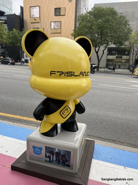

Onwards to Seoul Olympic Park, you might pass through some beautiful bike paths. The “corridor” is packed with stunning Autumn Foliage, and fallen maple leaves littered the ground.


South Korea cycling infrastructure is top notch!
Checkout the colourful toilets, and you will spot many “sports” corners too.
Outdoor gym, badminton and other activities.
Koreans are spoilt for choice. Toilets along Seoul bike paths

GS25, CU, eMart and 7-11 are your best friends. Refill and recharge. They offer the cheapest set meals too (at 5000 Won, but delicious).
I left my Insta360 at GS25, fortunately the staff found me seated outside enjoying my coffee. Thank You!

Seoul (Korea) is famous for Autumn Foliage.
And Seoul has a few majestic parks to admire the orange and yellow hues.
Besides Olympic Park, the other one is “Seoul Forest Park“.
(Although most tourists would only head to Nami Island)
South Korea had hosted 1988 Olympics and 2002 World Cup. Thus you can find Olympic Stadiums (Olympic and WorldCup) in downtown too.
I only had time for Olympic Park (as Olympic Stadium required a weird detour).


Supposed to be two rows of gingko trees along Olympic Park permiter. Would be awesome yellow corridor during full bloom.

Love this “fantasy” playground, background all yellow.
My phone camera is not doing justice to the actual colours! (which is more vibrant)


Muhly (pink vegetation) is on a small plot of land, but Gingko and maple trees are all over Olympic Park. I suspect Cherry Blossoms would also be blooming during Spring.

Near to this location (GPS 37.58286, 127.19616), my wheels ran over the crispy carpet of maple leaves! So soothing and therapeutic.
Refer my YouTube link (8min50s).


After exiting the busy hub of Seoul downtown, the bicycle traffic also reduced significantly.
Bikepacking 4 Rivers felt like an exclusive event for those who do Solo 🙂


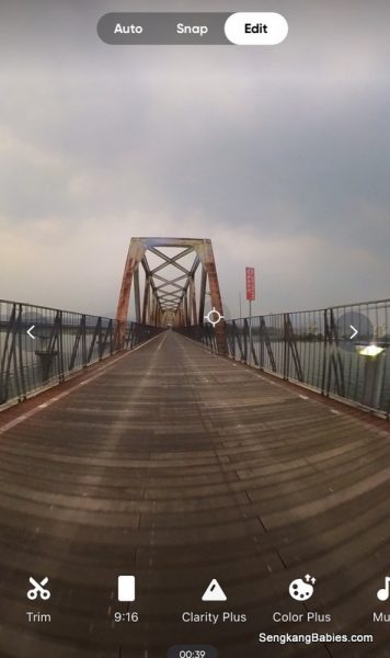
But the highlight for me was the wooden and Iron bridge (Yangsu Railway Bridge 양수철교) over the Hang Gang river (which is still part of Han river).
These were repurposed from old Train tracks.
When you roll over the wooden planks, it sounds like a mini train is rolling over.

1730 Early dinner Chicken popcorn (인생닭강정 두물머리점).
I needed to boost my energy, as I was still 50km from Yeoju!
Timing is very late, as I could only reach around 2000.
And Windy (app) had forecasted a thunderstorm closing in on me.

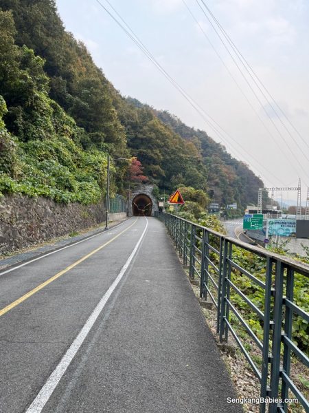
(GPS tunnel 37.53809, 127.34687)
Trains used to run through the tunnels, but now only cyclists and pedestrians.


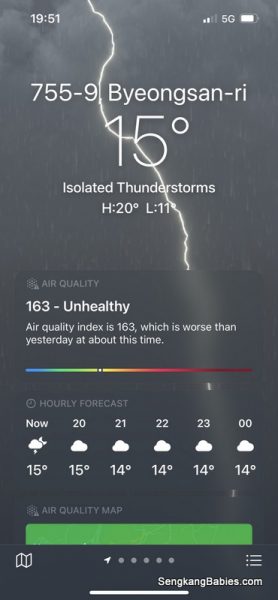
I tried to push through the incoming thunderstorm for 30-45minutes, but it was hopeless. Plan B required me to quickly search for nearest motel.
If I were caught in a thunderstrom, it would be dangerous and miserable. This was only Day 2.
Pushed through another 20km to reach my Motel. I was fortunate as the rain poured literally minutes after I checkin!

Checkin to motel at 1930.
I am 36km away from my planned end point in Yeoju.
This was a lesson to remind me not to underestimate the efforts and distance, yet I repeat same mistake at least twice :p
The motel 지오모텔 G.O motel was 1.5km from Yangpyeong certification booth (I needed to cycle across the river).
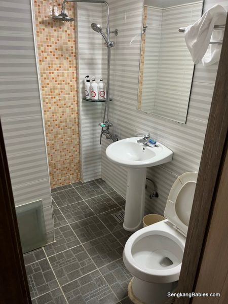
Basic motel, not for fussy folks.
But the boss (or administrator) was very friendly.
(I could not bring bike to room, thus chain to his scooter on first floor)

3) Motel cost
Fyi, a motel stay in Korea would cost between 40,000 to 60,000 Won. Decent quality and relatively cheap.
For comparison, a meal would easily cost between 10000-12000 Won.

Motels in Korea are also known as Love Hotels, but I did not encounter any sleezy incidents.

Dinner 18000 Won chicken BHC chicken.

4) Referring to Kakao and Naver map comparison
Below is is one more reason why we cannot 100% trust Google Map review in Korea.

I was searching for restaurants which opens late near motel. Two 24-hours restaurant was closed! Perhaps their operational hours were not updated post-Covid? Kakao and Naver Maps would have provided more updated details.
I ended up with BHC chicken for dinner. It was delicious, and boss was friendly. But the bucket could feed 3 pax, and I had to share with fellow motel guests.
So instead of 120km, I ended day 2 with 90km.
This means I need to start earlier to make up for the 30km deficit.

More Tips for Bikepacking 4 Rivers (newbies):
5) It is easy to underestimate the effort needed to complete the 633km Bikepacking 4 rivers trail. Some folks might assume since we are cycling on dedicated bike paths, it will be straightforward.
6) Do factor in the efforts and strains from multi-day cycling.
It will be more complicated when you attempt a solo trip.
I am not trying to scare people off, but we need to respect the efforts needed for 633km. Fortunately, there are plenty of online resources to help with your planning.
Some personal opinions.
7) Although most will say motels are readily available.
I would recommend researching some “populated township” beforehand (maybe mid day). You should be able to estimate how much more you wish to cover before resting.
Due to inexperience, I had to cycle in the night (total darkness) in some rural areas before I reach my motel. (20km distance might mean one extra hour of cycling, if average 20kmh)
Most importantly, you will miss all the scenic spots in the darkness!
RESOURCES:
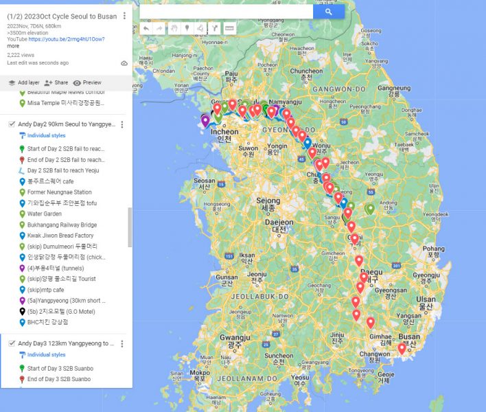
a)Part 1 and 2 of my custom Google Map will share my route, F&B and motels from Seoul to Busan. Do take note that I did not follow 100% 4 Rivers Route, skip Andong, and I did not search for all the certification booths.
I have indicated “Purple markers” to represent Detours and Slopes.
(Part 1 Seoul to Sangju) Red dots depict the Certification Booths.
https://www.google.com/maps/d/edit?mid=1wkn6Pfp_OownBmnRM_C3gOaBEOos-pU&usp=sharing
(Part 2 Sangju to Busan here)
https://www.google.com/maps/d/edit?mid=16LLQuW-Xw9wna0ifgsfTBmLnOzz74ug&usp=sharing
b)YouTube videos of my 4 Rivers trail (wip)
Day 1 Bike boxing, ferry and cycling from Incheon Airport to Ara West
Day 2 – 4 Rivers trail Seoul to Yeoju
Day 3 – Yeoju to Suanbo
Day4 82km Suanbo to SangjuSi (submit two mountains)
Day 5 90km SangjuSi towards Gumi and Daegu
Day 6 114km from Daegu to Namji (Hardest segment for me)
Finale. Day 7 95km from Namji to Busan (end point)
I am still working on the other videos, do browse through all the photos in album below.

c) 300+ Facebook photos over 7D6N
https://www.facebook.com/media/set/?set=a.10231495769562405&type=3
d) Seoul to Busan blog :
Day 0 Summary – Bike Boxing overseas and cycling from Incheon Airport to Seoul
Day 1 – Bikepacking Seoul to Busan – Day 1 cycle to Seoul downtown
Day 2 – Bikepacking 4 Rivers – Day 2 to Yeoju
Day 3 – Cycling Seoul to Busan – Day 3 Yangpyeong to Suanbo


