I am a Blogging Daddy of four. Our kids are roaming Singapore to bring you FUN,
This blog is use to capture our kids' growing up phases, and we want you to leave our blog with a smile :)
We just completed cycling to Safra Singapore, all six outlets. Safra is more well known as a hub for family entertainment, catering to NSmen.
2020 – Safra Punggol with two Randy Lims
But few might thought of cycling to all Safra outlets 🙂
Well, for those who have created a few RTI (Round the Island), we might have run out of ideas for the next ride. I have only done one RTI.
I mean, how many ways are there to cover Singapore, all 700 sq km?
-Day or night?
-Clockwise or anti-clockwise?
-Maybe try foldie, Mountain bike and Road bike?
.
Singapore is too small haha.
My best experience are still overseas, do read our Bangkok ride (family), Taiwan 4D3N (with 2 kids), and New Zealand (solo).
Video: Cycling Hualian to Ruisui
Back to Safra. We went slow and took 8 hours+, and almost 90km. As we cycled mainly on pavement and PCN, that explains the longer time duration.
If you are keen on Cycling to Safra Singapore, just open Google Map GPX link in your Google Map and follow.
There are six outlets, and we covered Punggol, Yishun, Jurong, Mount Faber, Toa Payoh and Tampines. Feel free to start from any branch.
Take note Mount Faber is hilly, and Toa Payoh is not really near to any PCN.
Refer to the GPX above, these are the legends for your exploration 🙂
–Safra (Red) (Just open the GPX link in your Google Map, and you can follow our Safra route, including detours)
You can traverse from Old Tanjong Pagar Railway Station to Rainbow Bridge. Since Tanjong Pagar Railway Station is now under renovation, the end point will be Spooner Road.
General direction would be -> Sengkang/Punggol-Serangoon PCN-Pelton Canal PCN-Kallang/Flyer-Shenton Way/Keppel Rd-Spooner Road carpark (Start point)
Green Corridor cycling route
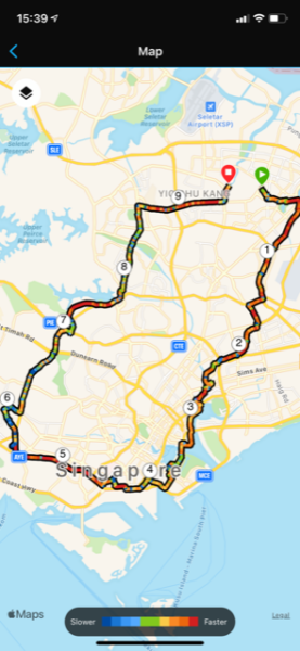
Cycling Green Corridor extracted GPX (Google Map) is at the end of this post. Map above shows 50 to 60 km loop back to Sengkang (via Queensway, Macritchie, Bishan)
From Sengkang, it will be roughly 20km one way to reach Spooner road. It might take between 2 to 3 hours depending on individual comfort level.
Second video shows our experience from Spooner Road-Green Corridor-Singapore Quarry (!)-Hill View offroad-Bukit Batok-Jem-Ulu Pandan PCN- Green Corridor. Total 40km (If include Sengkang, will be total 80km).
Video below, Off-road at Hillview (4:03min) is something new for foldies. 2:02 shows the 50m link between Green Corridor to Singapore Quarry. (Cross bridge GPS 1.355018, 103.769587).
This blog post (and video) shows the fastest way (not easiest) for Green Corridor cycling from Sengkang and Punggol.
You may cycle pass Marina Bay and Sportshub too. Once you reach Tanjong Pagar, you can turn East to East Coast Park, cycle straight to Sentosa, or explore West Coast Park.
Serangoon Park Connector towards Breadtalk HQ
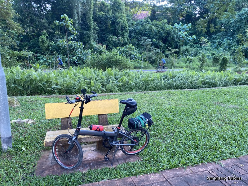
Startpoint can be Serangoon PCN along Sengkang (photo above).
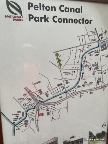
Head towards Breadtalk HQ junction, where three PCNS link you to Kallang. Refer Nparks PCN network for Balam Park Connector, Pelton Canal Park Connector and Kallang Park connector.
There will be two overhead bridges to overcome!
Those who do not wish to climb overhead bridges, can cycle from Sengkang to Bishan and follow the PCN from there.
This will add an additional 5 to 8km (one way). Another option would be Sengkang-Lornie-Bukit Timah-Kap mall, but I hate the Bukit Timah bumpy road.
First bridge in your PCN route goes over Aljunied road.
Use the groove to roll up the bridge. Harder for ladies as upper body strength needed. I find it easier to lift my bike (11kg) up the stairs.
Pelton Canal Park Connector route, just follow the river (drain).
Bridge two across PIE. This bridge is easier than the first one, less steep.
So far the best bike-bridge is still the one at Ulu Pandan, no need to dismount! (Jurong Circular Bridge).
If time permits, you can detour and catch some old “Lorong 3 Geylang” blocks which had been around 60 years and lease just ended.
Otherwise, just follow the river towards Kallang MRT.
Cycling near Kallang Park Connector, follow points 1 to 5 and route behind Kallang MRT. Cycle towards Flyer and Helix bridge direction.
If you follow “A”, you can head towards Sportshub, Tanjong Rhu and Marina Barrage.
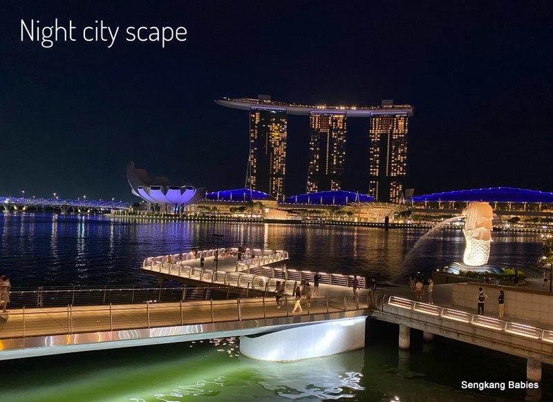
Cycle towards F1, Flyer, and MBS.
The river side cycling route is really scenic and offers the best view of our waterfront.
Sit at the Bench (Marina Bay) if you are tired (the other giant bench is at Level 2 Sportshub).
If you prefer another view, try Merlion and Shenton Way route.
But take note Shenton Way will be crowded with pedestrians (weekdays) and pavements can be narrow.
Road cycling is not recommended for newbies as there is too much traffic (and trucks) along Keppel Road.
From MBS, we can actually detour and follow Sheares Ave to ride South of Marina Bay MRT. Reconnect back at Shenton Way, near to Singapore Chinese Cultural Centre.
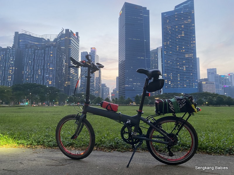
You get to see some nice city skylines from another angle.
Follow pavement along Keppel Road until you hit junction
(GPS 1.272750, 103.839986 ), which is before Tanjong Pagar Railway Station.
Take the PSA side of the pavement, as the other side is more disconnected.
Cycle towards Spottiswoode Park Rd (pavement) and head towards Block 101, 102.
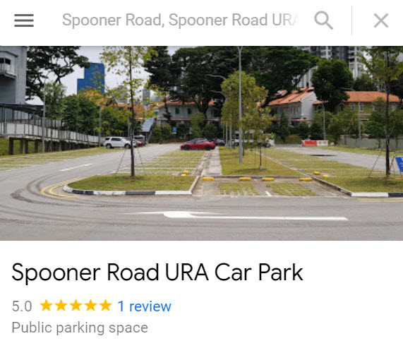
Refer Google Map below, “X” marks Spooner Rd URA Carpark.
From Junction 1, cycle towards 2. Push bike along 3 and take staircase (or slope behind bustop “Bef Kampong Bahru Ter“.
Seasoned cyclists can try Neil Rd (exit before bustop), but this stretch is narrow and packed with buses (too many blindspots!)
Point 4 is temporary entry to Green Corridor.
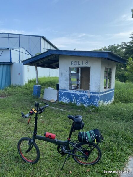
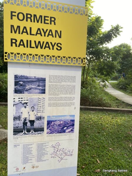
Point 5 is the old KTM “Polis Post”.
From Spooner Road, you can go all the way North to Kranji Close (24km). This was the REAL train route last time.
Our Tanjong Pagar Railway Station experience from 2010.
Enjoy Green Corridor cycling from here onwards. Do look out for walkers, joggers and pets.
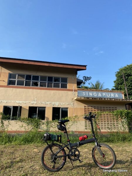
Green Corridor Old Polis Station
Entrance GPS “1.275297, 103.832482” (opposite Kampong Bahru Bus Terminal)
Green Corridor attractions.
Green Corridor cyclingMasjid Hang Jebat MosqueLost Ark
Old Tanglin Halt block
Do spend some time at Tanglin Halt to capture the colourful blocks.
Rail Corridor heritage
One of the most relaxing moments was people watching along the Rail Corridor.
Not too long ago, KTM trains were chugging behind Tanglin Halt’s backyard! (turn on volume to hear the birds)
For the return trip, I exited near Biopolis and headed towards Queensway, Farrer Park direction. Those adventurous ones can cycle till Bukit Timah or Kranji Close to exit towards Mandai Road (Much BIGGER loop).
Sugarcane drink to recharge at Empress Market, I seldom pass by this corner.
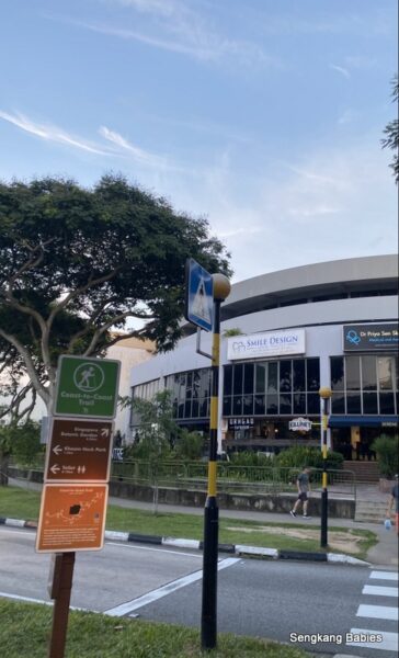
Photo below is the junction near Adam Food Centre. You can follow Coast2Coast trail back home.
After Kheam Hock Park, climb overhead bridge (again!) over Lornie Road. (First timers should be aware of the uphill slope and graves, refer YouTube 6:52 min)
It is illegal to cycle in the tunnel. Cars are fast in tunnel, and you risk exiting into PIE expressway!
Overhead bridge over Lornie road
Easy pavement on Lornie PCN. However Marymount and Ang Mo Kio Ave 6 has a lot of road works. Ride safe.
Additional Tips and Detours.
Cycle to Sportshub and Tanjong Rhu
1) Referring to first Google Map. Point “A” from Kallang MRT will lead to Tanjong Rhu and Sportshub.
You can still reach Spooner Road after a detour.
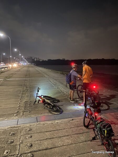
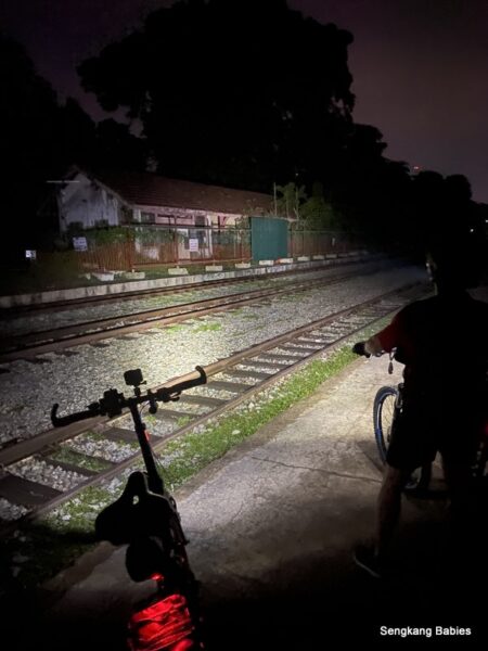
2)Ever wonder night cycling experience at Green Corridor? There is no light and it can be pretty eerie to cycle alone (Look at the main video, from 5:47 min).
It is all dark. Confirm all your senses will be tuned up!
With Buddy Randy, Green corridor can be eerie at night
I am more curious why some walkers and joggers do not bother to shine a light, or like to wear black!
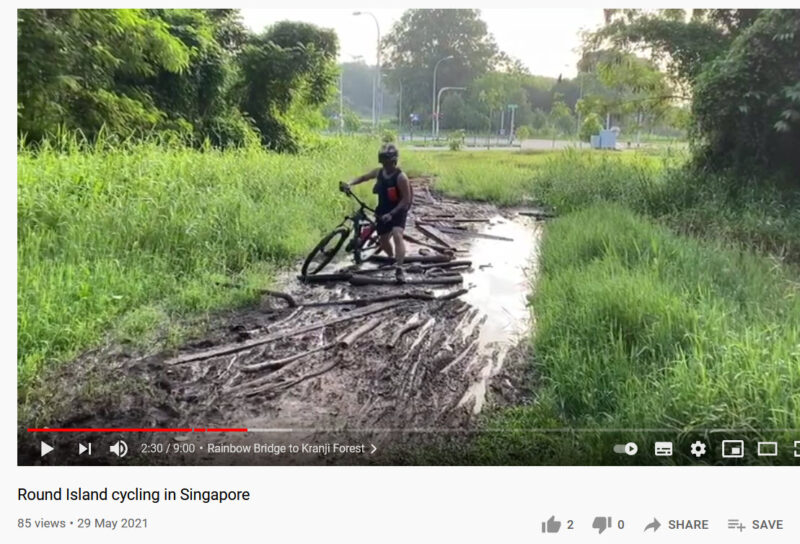
3)Next target. Cycle the whole Green Corridor. I am not worried about darkness or mud, but the weekend crowds are horrible. See the mud on the round-island video clip (from 2:00 minutes onward) from Rainbow Bridge to Kranji forest)
Click on Image below for YouTube video (Green Corridor muddy).
4) No1 tip for Green Corridor cycling.
Expect 5km of slight gradient if you start at Spooner Road. Just go easy.
5) Green Corridor (also called Rail Corridor) is not wide. It can only support 3 to 4 walkers across, cyclists should look out for pets too. Otherwise, enjoy the greenery and fresh air.
6) You may refer to the Google Map (GPX) for direction from Sengkang to Spooner Road. I have another GPX from Bukit Batok, Jurong to Green Corridor here