Sekinchan Paddy Fields and Container Stay


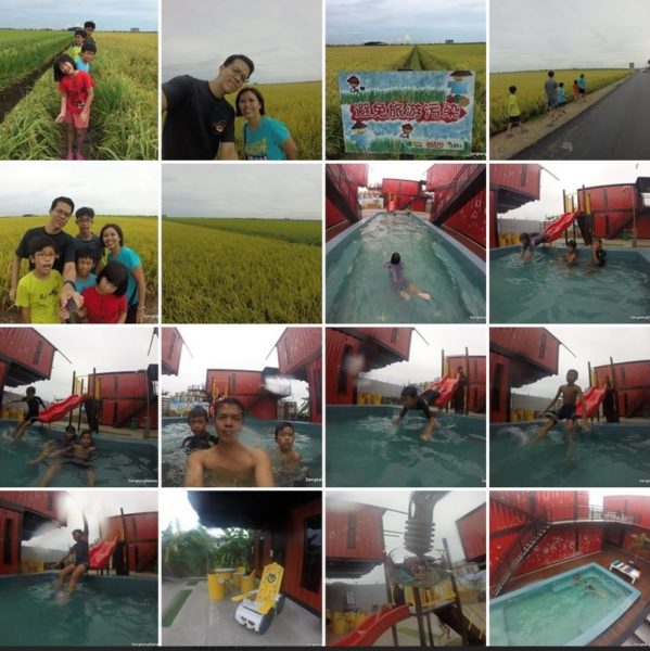
适耕庄 Sekinchan Paddy Fields (Google images) beckon to us, 鱼米之乡. Swaying stalks awaiting harvesting, Sundown and Sunrise casting a golden reflection across the horizon.

Take note there are only two Golden periods per year, during harvesting.

Sekinchan Paddy Fields

Our Sekinchan trip is dated 2016 May, read our 3D2N post here.


Sekinchan 3D2N Fun video (YouTube Link)  .. Got doggie escorts too

On the way North, we stop at Port Klang for Bak Ku Teh. Port Klang is famous for many other food (fish dishes especially) but we only got time for one restaurant.

Restoran Seng Huat Bak Kut Teh (Rated 3.5/5)
(GPS 3.043480, 101.448206)


Too herbal but aromatic. It was a good recharge before we proceeded North.Our favourite BKT is still Hwa Mei in Johor.

Google recommended nearby coffee shop for good Kopi and Toast too.
(Chong Kok Kopitiam 中国酒店, GPS 3.042634, 101.449485)


The best thing about road trip ids are we can stop and detour as and when we like. Refer map below, we always visit Kluang for 豆沙饼 too (Shop name at end of page)

As we are taking the coastal route, the rural areas present more laid back sceneries 🙂 There are many mosques along the way.

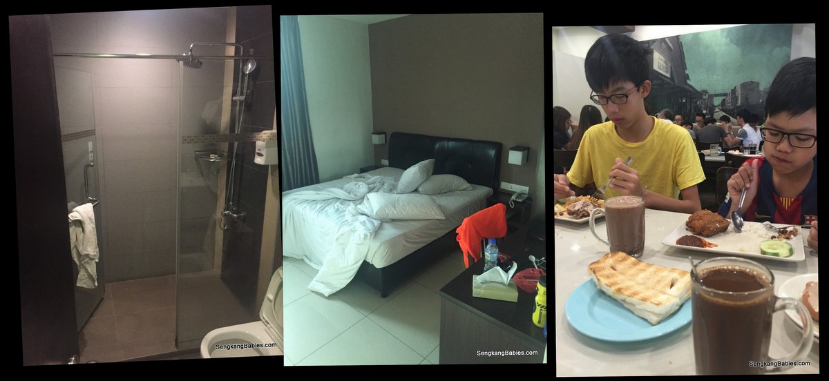
Reached “Container Hotel” . We have seen many F&B from Containers, but not much about accommodation.


Farm Ville cafe and Homestay (rated 3.75/5)
(GPS 3.50106 101.11100)
http://www.farmvillehomestay.com.my/home

I guess it is the novelty which attracted us. You have paddy fields all around, a short 10 minutes walk to nearby town (breakfast and dinner).

Comfortable bed for 6 pax. However, containers can be very warm during the day, we need to on aircon full blast.

Try to choose second floor for better view, and privacy. Do take note sound proofing might be lacking, we can hear kids playing trampoline on the roof.

Fortunately, roof is off-access from 8 pm onwards.

No4 Xin loves to bounce at the roof terrace. The roof also gave us a good view over the Sekinchan Paddy Fields horizon.

You can rent buggies or bikes to tour the paddy “avenues”.

The concrete structure in the background houses the swallows.

Or you can rent a nostalgic ride from “The House of Ah Ma” souvenir shop too. Driver (and tour guide) included.


Kids wanted to chill at the mini swimming pool.


We drove nearby for some nice desserts.

Mamawe Cafe (rated 3.5/5)
(GPS 3.507446, 101.102887)

We ordered ice cream and snowy mango for the hot weather. Lunch was chicken chop and black pepper chicken (so so).

Go for snowy mango, cool and refreshing.

There is a mini Night Market at nearby Town Center (Same place as wet market)


We woke up early on Day 2 but could not catch the Sunrise. We did spot many friendly dogs.

Coffee and Toast for breakfast and we are ready to go home.

We bidded Sekinchan GoodBye, with one more round of paddy fields. Do not leave Sekinchan without tasting their mangoes!

鱼米之乡
鱼米之乡


Before heading home, we always detour at 居鑾 Kluang for some famous 豆沙饼 (Tau Sar Piah).

Yuen Fatt Biskut 源發餅家
(GPS 2.042024, 103.333510)

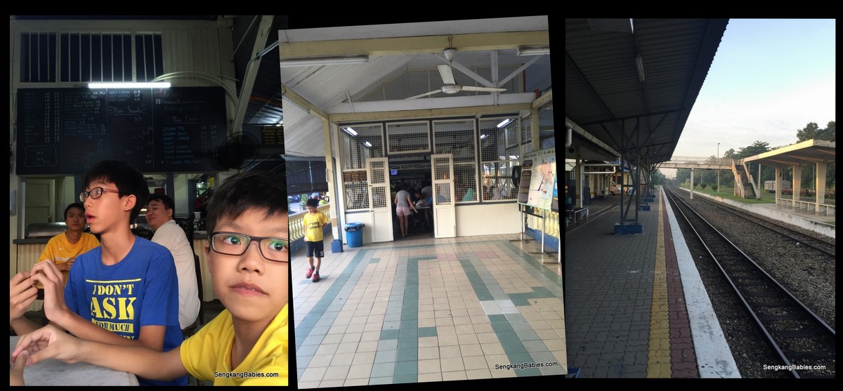
Traditional Nasi Lemak anyone? Kluang railway coffee

Kluang Rail coffee – original stall next to Train station
(GPS 2.033543,103.317584)


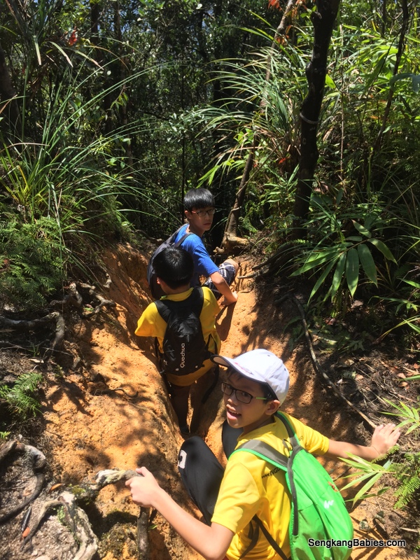
If Sekinchan Paddy Fields are too far away, there are some nearby in Kluang area (previous Farm stay blog post) . But the scale and beauty would be different.

Do pop by our Sekinchan Facebook photos, Day 1 and Day 2.

Our 3D2N Family itinerary is listed below (https://sengkangbabies.com/holiday/3d2n-sekinchan-family-trip)

.. read our 2018 Sekinchan Padibox stay

3D2N Sekinchan family trip

Hiking Gunung Belumut, our first 1000m summit

Love the morning Sun rays when we were Hiking Gunung Belumut! It was also how my heart was fluttering at the thought of another hike. Gunung Belumut is our first 1000m mountain 🙂
IMG_6341

Before this, our highest peak is Gunung Panti.

The numbers for Belumut.
4hours up, 3hours down.
15km to and fro, with the peak at 1100m.
To make it more challenging, rain fell 3 times!

We left home at 0445 and reach our breakfast venue at Kluang Rail coffee (GPS 2.033543, 103.317584). It is a real train station famous for coffee and toast (Opens at 0700).
20160716 Gunung Belumut

Nasi lemak (and Mee siam) only cost RM0.90 sen each! And there is only chili and white rice but the chili is solid! We suspect train passengers will buy these fantastic food for their meals.
20160716 Gunung Belumut1

A half an hour drive away, we reach the base of Gunung Belumut (GPS 02.06715 103.52507).

From a distance, we can see Kluang is surrounded by mountains. Mist constantly floats down to cover the road, heightening our anticipation.
Gunung Belumut GPS

Make shift carpark among the palm oil plantation.
IMG_6329

Hiking can be a good analogy for Parenting, or rather what I wish my kids to learn through Life.

Hiking can be dangerous, a single trip, slip or twist could mean fractures, sprains or even death. Like any sports, we need to exercise caution, take care of each other, anticipate dangers and be alert.

We need courage to step out of our comfort zone, and that’s when we learn more about ourselves.

I always tell them. Death comes to everyone and there is nothing to fear (or feel morbid). If our time is up, even crossing the road can be dangerous.

Life is really short (how many 20 years do we have), and our human body is so fragile. I only hope we will have minimum regrets at the very end 🙂
Gunung Belumut hike

The “Before” photo, all eager to hike Gunung Belumut.
Starting bridge and pond, make us wish to dip inside the cooling water.
20160716 Gunung Belumut4

From the beginning, a lot of fallen trucks lay in our path and we need to go under or over. Taller guys will need to constantly bend down under the trunks, I lost count of how many times my backpack stuck the ‘tree trunk belly’.
Gunung Belumut checkpoints

The map call Gunung Belumut a “recreational” forest, but we were sweating buckets and we had to climb on all fours at times.
It is always refreshing to reach the next “flat” ground.

Catch up with our breathe and water parade in preparation for the next slope.

20160716 Gunung Belumut7

Besides the hike, we need to enjoy the surroundings too. Termites trail, and a huge leaf (to wrap Nasi Lemak haha)
20160716 Gunung Belumut12

Pear-shape tree, ferns and mushrooms. The root on the right looks like a hammock.
20160716 Gunung Belumut16

Checkpoint 1 (around 3.3km mark). It was uphill up 60 degree gradient for the next 600m!
20160716 Gunung Belumut6

Kids helping each other over the obstacles, or finding an easier path to climb. Sometimes, I purposely keep quiet and let them figure out the next step or ‘rope’.

Kids are always tougher than we give them credit for 🙂
Gunung Belumut review

Sense of achievement? Perhaps, but they do treasure the companionship and jokes along the way.
20160716 Gunung Belumut13

Checkpoint 2 (around 4.6km), some weird rock formation here. Looks like a walled fortress or a stage 🙂
(Checkpoint 1 to 2 is only 1.3km, but steep terrain means we need 50 minutes to reach CP2)
IMG_6413

Face towel was useful to stop the perspiration and block some rain too.
IMG_6446

Our guide say this was the 80 degrees wall, we had to climb up by navigating in a zigzag manner, left to right to left again. Make use of the roots.
Gunung Belumut with children

It lead us to a rock face, and we need to skirt behind and up.
Gunung Belumut experience

The rain started falling after checkpoint 2, and we were caught in 3 downpours! Besides the slippery and muddy slope, our pants and underwear were all soaked.

Checkpoint 3 is around 5.6km mark, I did not see the sign or landmark.

Hike higher, and you will see moss-covered branches and rocks. I was looking forward to some moss carpet, common in higher altitude.
20160716 Gunung Belumut10

A fake summit (around 8km mark), the real summit is 20 minutes more to the left 🙂
Gunung Belumut fake summit

Finally the summit. But Gunung Belumut summit view is actually not spectacular and it was crowded.
Gunung Belumut height

We completed the hike in 4 hours plus. I was so excited that I forgot to sing Boon Kang a Birthday song haha. I had plan this hike as an advance Birthday gift for him 🙂 (We did sing a short rendition on the way down, see video below)
Gunung Belumut with family

We u-turn to have our mini lunch at the barren “fake” summit.
Our hiking brunch and lunch include :
– x4 1.5l water
– x3 100plus
– x6 banana
– x4 bread, baked beans and tuna (do not bring pork up hills and mountain in case we offend some spirits)
– x6 butter biscuits
– x4 sandwich

It was a heavy load to bear for up to 5 hours! We start our descend at around 2pm.
IMG_6526

There are a lot of “drains” to wade across. They become mini waterfalls when the rain fell. As we climb lower, it became darker and we were glad to exit at around 1730.

Although we were slightly behind time, it was crucial that we be extra vigilant and watch our steps. Kept reminding the kids that we might get careless when we are tired, and a slip would only make the situation worse.
IMG_6535

Hiking is a good way to bond and see the kids’ characters. We must help each other, motivate and encourage the weaker ones.
I would rotate the “leaders” so that everyone has a chance to lead and identify the markers ahead.

Kids would volunteer to share the load around so that no one is overly stretched. Hiking is a team effort and we need to reach the summit together.

Most importantly, always remember to have Fun!
We hope Mommy and princess can join us soon 🙂
IMG_6241

Video (link) : Photos cannot capture the kids’ persistence to conquer Hiking Gunung Belumut

Proceeded to checkin at our hotel for the night at Rail Hotel (GPS 2.023473, 103.311938 ). I was worried that legs will be too numbed to drive back to Singapore :p
Rail hotel Kluang

King sized bed for RM150, including breakfast voucher of RM24. Recharge before driving home the next day. I knock off at 10pm while the kids were still playing games.

From the map below, Gunung Belumut is between UK Farm and Koref.
Kluang surroundings

Do your staircase training before attempting Gunung Belumut, my calves are still straining after two days.
If you are first time hiking, go for the 500m (or below) Johor mountains first (Panti, Arong, Pulai, Lambak). All are within 2 to 2.5 hours rive from Singapore, and a good start for children. In Singapore, Bukit Timah Hill (163m) and MacRitchie Tree Top walk would be a nice warm up. (Panti is 3 times harder than Bukit Timah, and I felt Belumut is easily 2 to 3 times harder than Panti)

Our hike was made possible with Facebook group “Freewill Hikers“. Guides and permit are needed for hiking Gunung Belumut (For our group of 45, we need to pay RM 40 per head).
We first hike up Gunung Panti (500m) with Free Hikers too, do join their group for future events.

More hiking photos uploaded on our Fanpage album.
Read all our hiking stories here.

ps.. Follow our Instagram tag #SengkangBabiesJohor for more JB adventures