Cycling to Elephant Rock (Bukit Batu Gajah)

Cycling to Elephant Rock in Senai Johor. This was what 14 of us did early September 2022.

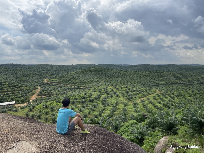
We have seen the various trips undertaken by other cycling kakis, and the mesmorising green palm oil plantations from the top!

Elephant Rock, also known as Elephant Hill Rock is located at Senai, Johor. The official name is (Bukit Batu Gajah 柔佛州泗隆象石山).

Actually, this rock is more popular with hikers than cyclists.

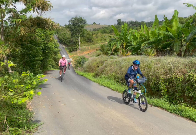
Elephant Rock is about 40km from customs, and take note of the almost 1000m elevation (aka slopes) from my Strava screenshot. This tour is challenging for new riders, build up your fitness with slope trainings first.

Refer Google Map screenshot below, follow my GPX for links and tips to reach trailhead (gpx link). (Viewing experience is better on Desktop rather than mobile phones).

Tip 01 Refer to our Cycling to Elephant Rock YouTube clip below.

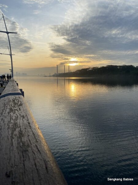
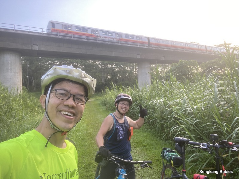
In summary we headed towards Elephant Rock, then Eco Spring for lunch before heading back (passing Mount Austin).

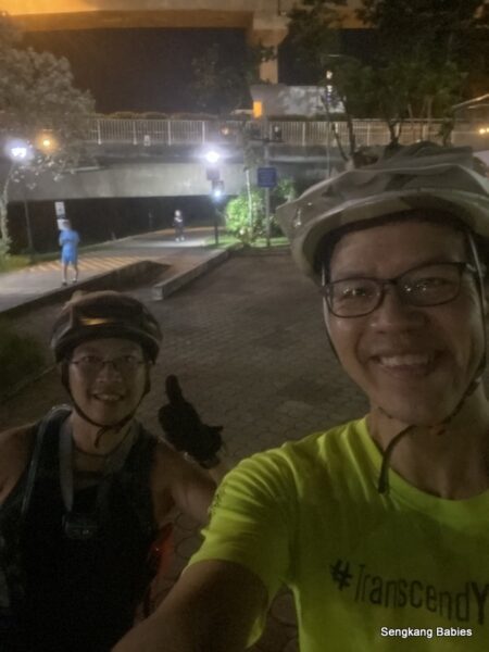
0600 set off from Esso Woodlands Road.
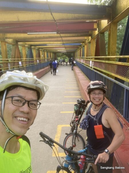
Took our customary photos at Causeway.

Cycling to malaysia

0730 Breakfast at Kedai Xuu Yau . Shop is very low profile, my favourite wanton noodle.

Kedai Xuu Wanton Noodle JB

Tip 02 Route J3 slopes!

Good workout for us, up down roller coaster slopes for up to 8km. The toughest parts are after Larkin Bus Terminal, sapping our energy.

For chaps who wish to explore beyond Johor, Larkin Bus terminal is where you hitch a ride to Malacca, Selangor, Mersing, Terengganu etc!

In comparison, J3 slopes are easily x2 x3 times tougher than Mandai slopes.

Actually the slopes begin once you touch J3 along Taman Merdeka (park). Checkout 30s from my YouTube clip . Good training 🙂

Endless slopes J3 route Johor

The slopes get easier when you are nearer to Starhill Golf and Country Club (or maybe we are numb already).

Do look out for two HUGE Boeings at the parking lot! (GPS estimate 1.558578, 103.713771). This is in Kempas neighbourhood.

Johor Kempas Boeing aeroplanes

Retired Boeings! Just curious who parked the planes there, and for what purpose?

Tip 03 Pitstop before Elephant Rock.

From the aeroplanes corner, we would recommend having a pit stop at Kampong Maju Jaya (GPS around 1.581363 103.718755). There are 3 to 4 coffeeshops here and a few convenience stores.

Take note road condition along Kampong is more bumpy and has more pot holes.

Refill your water, clear your bladder. You are less than 10 km from Elephant Rock. We noticed there are some roadside stalls selling drinks and snacks but we gave it a miss (would be cool to grab some coconuts).

Oh, we found out Kampong “squatting” toilets are clean 🙂

Tip 04 Trailheads and access

There are actually two trailheads to submit Bukit Batu Gajah.

(Refer photo below) Point 2 (GPS 1.639369, 103.734652) is nearer, you can park your car and walk less than 2km to submit. Point 3 is further (Petrol Felda Ulu Tebrau), follow directional signs and hike 6 to 7km one way .

Trailhead Elephant Rock

For point (2), those who are driving should park around the neighbourhood here (GPS 1.639206, 103.729393). We cycled to Point (2).

Bukit Batu Gajah car park area

From photo above, go up the left trail and you will encounter a “FUN” slope. It is important to enjoy the journey and pitstops, as this will make the trip more memorable.

Foldies cycling to Elephant Rock Johor

*After the slope, do look out for a side gate (GPS 1.639422, 103.732887), and trek offroad 400,500m to the rock.

If you overshot the gate, you will see “old hut” up the slope.

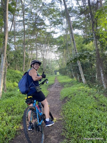
Once you pass the gate, start pushing and walking on trail. I suspect the trail will be muddy if it rains. If you have wider tyres or MTB, cycle in all the way!

Tip 05 Cleats are not welcomed here

You can try to climb the rock face with your Clipless  😅

We can see the ROCK infront of us, turn left at the T junction infront.

Bukit Batu Gajah off road trail

I still cannot tell which part of Rock resembles Elephant. After this portion, the last 100m offers a good workout with your bike! PUSH!

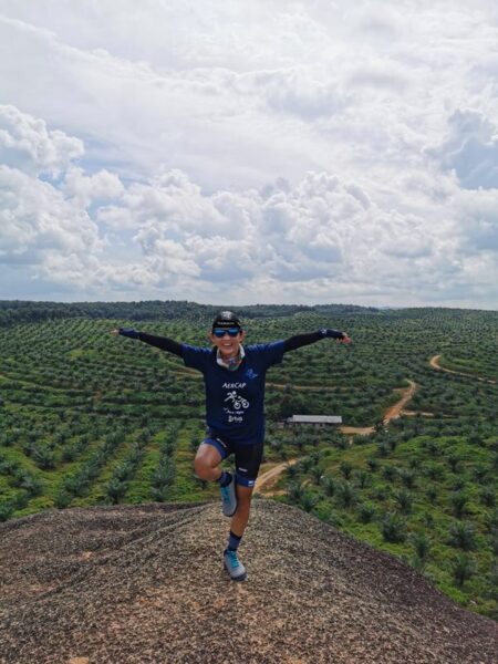
Park your bikes, go and explore the batu (rocks!).

Bukit Batu Gajah photo

The ROCKS are HUGE!

Take more photos! We spent almost 1 hour at Elephant Rock.

We can see beautiful green scenery 360 degrees. No wonder so many happy faces 🙂

Bukit Batu Gajah photos

From Elephant Rock, we only 13km from Senai airport, or 20km from Mount Austin. Pack up to next stop.

We detoured to Specialized bike shop. Window shop only, not enough budget 🙂

From here, we are only 7km from our lunch venue.

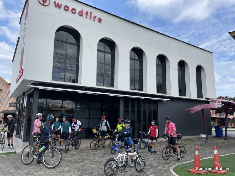
Tip 06 Lunch and photos  at Eco Spring.

This new corner has many Instagrammable spots and popular cafes.

Please order some juicy burgers at Woodfire.

Woodfire burgers Eco Sprint

We stayed 1 hour at Eco Spring(woodfire lunch and photos). This spot is popular with both couples and families, plenty of activities and cafes for everyone.

Best burgers Johor


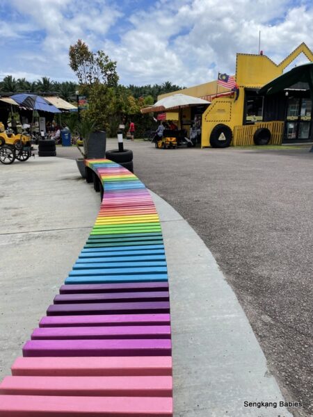
Eco Spring Lab photos

The original plan was to pop by Mount Austin for coffee. But we decided we had enough fun for the day and decided to ride home.

Tip 07 Route Mount Austin to JB

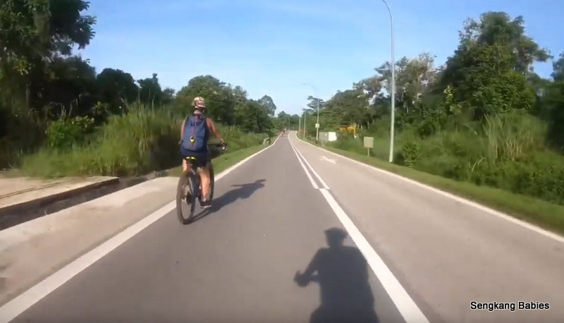
Route 3 would be the fastest path. Take note minimum shoulders and faster cars. We would recommend Route 35 (through Permas Jaya) and Stulang for new riders.

Cycling to Elephant Rock Google Map

Do expect more SLOPES up and down along Route 3 towards Taman Sentosa direction. Do take note road condition is more rough and more pot holes too. (This is the same route 3 which can bring you North to Mersing)

Checkout YouTube of Route 3 below. There are always plenty of slopes for the return trip (towards SG custom).

If time permits, you can detour to Plentong Go Kart (off Permas Jaya). Read previous blog post here.

Gokart Johor

Credits and references:

a)Thanks to other pioneers for sharing their Strava or Google Map GPX. You can reference our own GPX link here. Just open in your mobile phone and follow turn by turn. Our Elephant Rock YouTube link is here

b) Cycling to Elephant Rock would not be possible without the rich resources from Facebook group Cycling SG to Malaysia Facebook group. This should be your one stop shop for your Johor/Malaysia cycling research. More photos and videos about Elephant Rock here

Meanwhile, you may read about other cycling trips below:

– Cycle to Pekan Nanas and Legoland
– JB food hunt (3 hours 30km)
– Cycle to Forest City
Cycle to Pontian (笨珍)
Cycle to Elephant Rock (Bukit Batu Gajah)
Cycling to Malacca (3D2N)
Cycle to KL (2023 5D4N)
2018 Cycling Hualien to Taitung (with two kiddos)

YouTube: 2 to 3 Hours in JB. Eat, see and Experience

YouTube: Chill at Pontian 笨珍

YouTube :Cycling to Forest City and boat ride (my best Johor trip yet)

YouTube: Cycling to Elephant Rock (Bukit Batu Gajeh)

YouTube: cycling to Malacca

YouTube:Cycling to Putuo Village

YouTube:2023 Cycle to KL (5D4N)

Cycle to Desaru and Sedili

Cycle East Coast Kuantan, Kelantan, Titiwangsa, Betong, Penang (preview)

Cycling In Taiwan (250km from Hualien to Taitung)

*Do follow our cycling adventures here -> https://sengkangbabies.com/tag/cycling

Round Island cycling in Singapore

Round Island cycling done! I have finally covered Singapore on two wheels.

Depending on your route, it can be between 110km (without Tuas) to 160km (Including Tuas and Lamp Post 1). Duration could be between 8 to 12 hours (including breaks), fitter cyclists will complete faster.

If you cycle on the road instead of pavement and PCN, you will shave off more time. Pavement requires one to detour more and watch out for uneven grounds, and other obstacles like bends and bus stops. Road is faster but also more risky.

YouTube link

*Refer to our Google Map (GPX) or Strava link too.

We took some sightseeing detours to Rainbow Bridge and Kranji Forest just for FUN and mud. Thanks to buddy Randy for leading the way and companionship.

0600 : Set off from Legend Sengkang (is it really Legend now, closed permanently?)

We did our Round Island cycling in Singapore anti-clockwise.
I would say the toughest segments would be Neo Tiew (slopes) and Tuas (dust and sun). TMCR (Tanah Merah Coastal road) is relatively easier, although it is 15km.

环岛追追追, our journey took us through the following areas.

=== ===
Sengkang-Canberra-Admiralty Rd West-Woodlands Jetty-
Admiralty Rd-Rainbow Bridge-Kranji-Lim Chu Kang-
Jalan Bahar (Boon Lay Way (Jurong Central Park & Boon Lay MRT)-
Safra Jurong-Safti-Joo Koon MRT-Gul Circle-Tuas Crescent-
Tuas West Road-Tuas Link-Pioneer Rd-Jalan Buroh-Pandan Reservoir-West Coast Park-Labrador Nature Reserve-Keppel Road-Marina Barrage- East Coast Park-TMCR-Changi Village*Home
=== ===

You may refer to the visual guide from below Youtube clip too. His path does not include Woodlands and Lim Chu Kang, Tuas, but it does show how you can cover most of SG on PCN and pavements.

It is tough and boring to do Round Island solo. We push each other along the way and keep our spirits up with jokes and gossips :p

Bucket list ticked, on to more cycling adventures!
Perhaps cycling from Singapore to Malaysia after borders reopen.


Woodlands Jetty sunrise

0720 : Reach Woodlands Jetty in 90 minutes.

Totally empty stretch near Woodlands Custom, vehicles used to jam all the way up to Woodlands Road.

Take note opening hours of Rainbow Bridge is 0500 to 1000, and 1700 to 2200.

[Detour alert] I am adding these alerts so you can choose to focus on the real route and conserve some extra energy 🙂

Rainbow bridge

Both Rainbow Bridge and Kranji Forest are not part of Round Island cycling. We detour to these segments just for fun.

Who knew my foldie would survive the muddy trails. I definitely had a lot of fun navigating through the soft grounds.

From here (Kranji Close), you can cycle 20km along Green Corridor and end at Spooner Road. Trail will be easier (green patch) and the other muddy section would be near “Sungei Kadut and after Hillview MRT”. See the photos from my previous hike (blog post).

MRT viaduct Kranji Forest

Enjoy scenic Kranji Forest and take some photos before we head to countryside “Kranji and Lim Chu Kang”.

My poor Crius Master and new Schwalbe Marathon tyres. Coated with a layer of mud. But I will gladly go through this experience again!

Can Foldies go off road

SG is building more RIR (round Island Route). One day, it will be more fun (and safer) to cycle along Lim Chu Kang, Neo Tiew and Tuas.

First timers to Kranji and  Lim Chu Kang should attempt weekend, lesser traffic (especially trucks). Personally, I am more worried about packs of cyclists who travel in groups and overtaking closely, more than passing vehicles.

Cycling Kranji Way and Neo Tiew

0850, almost 3 hours to reach old-school bus stop. The stretch ahead (between 8 to 10km) will have no shelter.

Lim Chu Kang bus stop

We turn right at Jurong Central Park junction and headed towards Joo Koon direction.

1000, 4 hours to reach Joo Koon MRT and FairPrice Hub building.

From here, you are about 9km away from Raffles Marina (or the more famous Johor Straits Lighthouse). Just follow MRT stations in map below, Gul Circle, Tuas Crescent, Tuas West Road and Tuas Link.

MRT stations in Tuas

Tuas is good for cycling during weekends, when there is lesser traffic and dust. At Tuas West Road MRT, you can cycle an extra miserable 15km (one way) to Lamp Post 1, refer IG post (just follow Tuas South Ave 3).

Cycle to Lamp Post 1

1030, cycled almost 30 minutes from Joo Koon MRT to reach end of MRT line at Tuas Link.

Do take note Raffles Marina (and Light house) entry is blocked during heightend Covid 19 measures (until 13 Jun 2021).

Raffles Marina club

Can you spot Tuas Custom below? We want to go JB massage, shop and eat!

You may read our Cycle-West post for more attractions in the West too. Considering we are at the West point of Singapore, we now have to cycle to the East side!

Although the hardest segment Lim Chu Kang and slopes are over, it is little consolation that we still have 80km to go. 加油!

Stopover at SPC Jalan Buroh for quick refreshment. Seems like this is a popular pit stop for both cyclists and truck drivers.

1200, reached Pandan Reservoir. Supposed to feel relaxed with water body but we felt so WARM! No thanks to Merciless sun.

[Detour alert]

Cycling round island map

But Pandan Reservoir view can be scenic. We heard Pandan Reservoir will be infested with midges during certain time period too.

Take note this reservoir is a detour from our RI loop ok.

Shades along West Coast Park. 

1239, reach iconic Haw Par Villa for photo stop. We have been on the road for 6 hours plus.

Singapore Round Island cycling

Tabao Nasi Ikan (fried rice) from Macik. Told Auntie “little” chili but the spice was potent! I had to cycle until East Coast Park (a bit exaggeration) to wear off the spiciness, lucky no stomach upset.

Disclaimer: Nasi Ikan is tasty, just that cyclists should avoid spicy oily meals (perhaps) :p

[Detour alert]

Cycling through Labrador Nature Reserve and Keppel Bay segment.

Labrador Nature Park

Take note some segments are not bike friendly, there are notices for cyclists to dismount and push. Regulars will cycle under West Coast Highway towards Tanjong Pagar, and experts will cycle along viaduct.

The sea view and shades at Labrador are worth the detour.


Time check 1415, cycled through Tanjong Pagar and behind Gardens by the Bay. Some would prefer the scenic views around Marina Bay, but we chose a remote detour (less crowded).

1500, 9 hours on the road. We have already clock 105km at this point.
Man, I desperately need an ice cream reward, 7-11 at Cyclist Park.

We are in no hurry, so we cruise along to enjoy the shades at East Coast Park before getting scorched along TMCR (Tanah Merah Coastal Road).

1550, torture time, 15km to go before Changi Village. No slopes (unlike Lim Chu Kang), but just straight boring route.

Cycling TMCR Tanah Merah Coastal Road

Boring lor, no view, no shelter.  You know the worst is over when you reach beautiful Changi Beach Park.

Round Island cycling at Changi

1620 Bandung time. We are getting indulgent but we just want to give ourselves a pat on the back. Well Done.

You have no idea how refreshing bandung (or Sugar cane drink)could do wonders to charge your spirit and energy!

11 hours to complete our Round Island cycling in Singapore. We cycle mostly on PCN and pavement. It will be faster if you go with companions and travel on the road.

RI Mission done, achievement unlock!

Cycling round island RTI

Special mention to my cycling buddy. This chap is super fit and really powers through his Marlin MTB! If he drops his 6kg+ backpack, he will FLY!

Thank you for bringing me to see and experience all the corners of Singapore.

This sounds weird, but I will remember the DETOURS more than the RI route itself. All are good memories.

Round Island cycling map

This is the longest trip submission for my OCBC 2021 mission. I have only  registered for the 42km category, guess I should aim for 100km category in the future.

OCBC cycle 2021 completion

Updated 2022 May. Refer Google Map GPX for RTI inclusive LP1, total 170km.

RTI Map on Google MAP GPX

Meanwhile, read our bike adventures:

-Cycle 70km East, TMCR (link)
-Cycle 80km West,Lim Chu Kang(link) (LCK slopes are tougher than TCMR)
-Cycle to Woodlands and back for 50km (link)
-Cycle 50km to explore 3 Reservoirs and 3 parks
-Completed Round Island 140km!  (Click for GPX routing)
-Cycle 20km to Green Corridor (or Marina Bay and Sportshub)

-Click for Instagram SengkangBabies #skbCyclesSengkangBabies cycling

*Read my previous posts about MTB\RoadBike\Foldie selection, & Foldable bike shortlisting
-Previous OCBC Cycle trips for families
-More details and landmarks about Park Connectors (PCN) at nParks link
-Follow my family’s cycling experience here .