Hiking Kranji Forest from Bukit Timah Green Corridor

Hiking Kranji Forest was on my to do list. First, we heard about the accidental clearing by JTC’s contractor, then I saw Brice’s awesome drone footage!

You may follow my Google Map GPX for the North route.

How can this be Singapore!

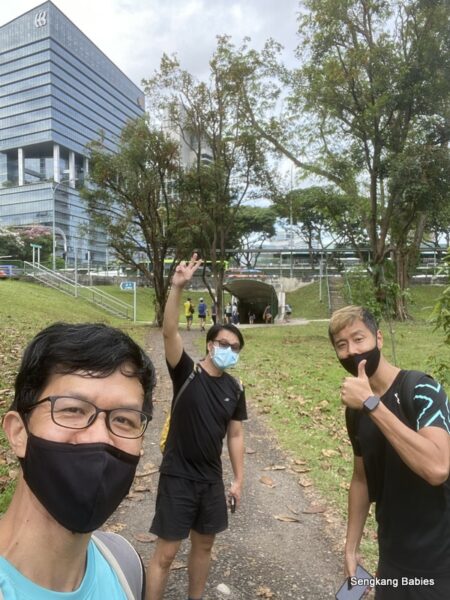
The opportunity finally came when I gathered with my friends to hike Clementi Forest. I proceeded to walk 17km to reach Kranji Forest.

Click to read my Clementi Forest and Green Corridor hike posts.

On a side note, walking is one of the best ways for me to clear my mind. Just walk and reach the next checkpoint, detour when you feel like it. Take some photos and enjoy nature.

Even when you are lost, there is a sense of liberation! Sense of freedom, getting away from day to day mundane duties 🙂

First tip for Green Corridor. AVOID weekends!

Just head North all the way. It is very hard to get lost. You might detour a bit, but you will likely be on a parallel track.

Example, the stretch behind Hillview Mrt is still not ready.

Walk about 300m along Upper Bukit Timah Road until you hit GPS 1.365542, 103.766719. Turn left and continue along the green rustic canopy.

(Take note Hillview side of Green Corridor will be closed till q2 2024)


14km point is near to Mindef Gombak.

Walk towards Junction 10, and you will spot Bukit Panjang LRT zipping across.
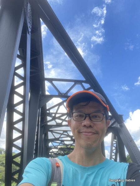
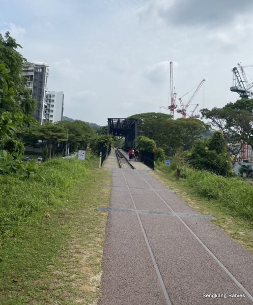
Old KTM structure.

Cross Choa Chu Kang Road, and I landed on Pang Sua PCN.

I suspect the authentic path should be to route East of Junction 10 and walk towards the Heavy vehicle carpark (GPS 1.381487, 103.758940). But Pang Sua PCN is more scenic 🙂

Pang Sua Park Connector

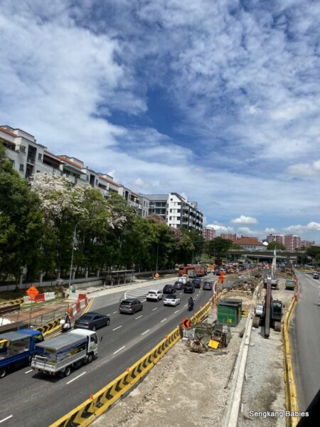
I would recommend Junction 10 for your rest stop or toilet break. As you head North towards Sungei Kadut (another 4km), it is harder to find coffeeshop, 7-11 or petrol kiosks.

Cool treats to reward myself, 17km is not exactly a walk in the park. You will be surprised how ice cream can motivate your brain to go further 🙂

Imagining myself in a temperate country‘s wood lands, but alas the humidity got to me.
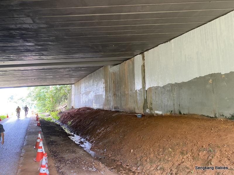
Walking under KJE.
Nparks just announced a new bridge to connect to “Villa Verde Park” .

Heavy vehicle carpark at Stagmont.

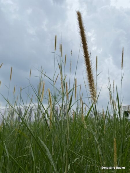
As you walk along these bushes, listen for all the weird insect buzz and birds crooning. Rail corridor is so ALIVE!

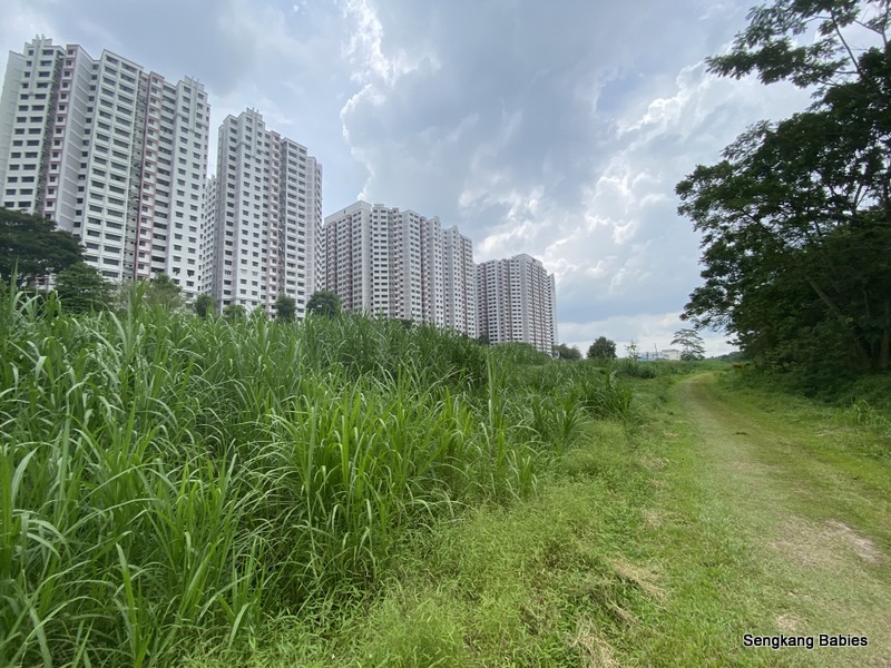
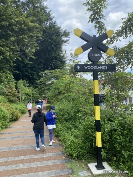
18km point, this kilometre marker starts counting from Tanjong Pagar terminal.

Refer Google Map below. Point 1 is start of Pang Sua PCN, next to Junction 10.

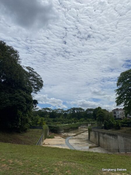
As you depart from Pang Sua PCN (near to point 3), and head North towards Kranji. You are walking in parallel to the “lesser developed” Pang Sua river (between Point 3 and 4).

Pang Sua PCN and river map

Had seen Min Desmond enjoying his kayaking there. Looks cool!

Image credit Desmond Lee FB

Spotted many free roaming chickens and chicks around this stretch! Feels like a Malaysia Kampong backyard.

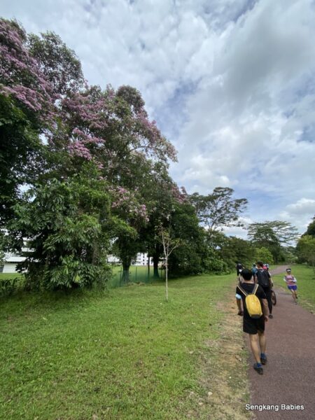
You will notice the trail gets more rustic as we leave the HDB blocks behind.

Watch out for heavy vehicles at the bend along Sungei Kadut Avenue.

Familiar Mandai Shell station, cyclists will know this point.

How rustic do you wish to get? Mud and mangrove galore 🙂

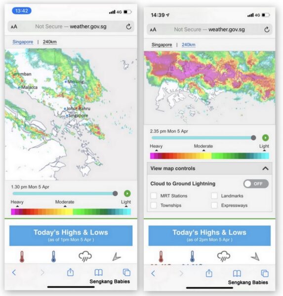
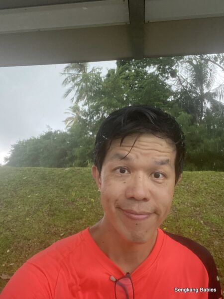
About 1km from end-point, the rain could not wait any further…

Actually, the rain had been creeping up on me since Hillview area. Felt a bit guilty about that extra 15 minutes of ice cream indulgence time :p

Train from Kranji station heading towards Yew Tee.

Quicken my pace as dark clouds loom.

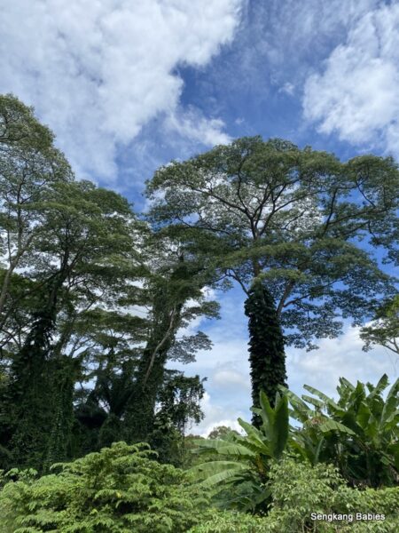
Kranji Forest looks magical.

But take note many fallen branches line Kranji forest. Be alert and try to go with a partner. This place is too isolated.

The track is a cycling heaven for mountain bikes (MTB), but foldies will struggle (mud and terrain). One fine day (not muddy), I will bring my Crius Master to cycle in reverse direction from Kranji Forest to Tanjong Pagar Terminal (Spooner road).

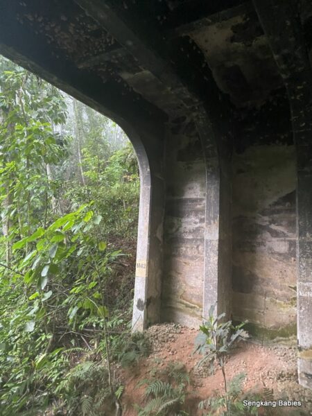
The only shelter along the trek North to Kranji Forest would be under MRT viaduct or the bridge structure below.

I took a short break here for 5 minutes, but decided to proceed as the rain will only get bigger.

Year 1842!

Although the blog post is titled Hiking Kranji Forest, this stretch is only 600m!  But it does look like a scene out of a fairy tale.

The mist added to the mystery aura. So Enchanting!

Kranji Forest Mist
Kranji Forest Mist

We can see the boarded sections along Krangi Woodland Forest. This section is close to Kranji Close entrance.

Fortunately, I had decided to hike on, as the drizzle became a downpour. I would be stuck if I had decided to stay at the shelter.

Take note Kranji Forest can be flooded as the streams on both sides will overflow. (Take note the toads will be super loud too!)

Kranji Close junction

Exit Kranji Forest junction totally drenched but super ecstatic.

Changed and took a bus to Woodlands Interchange (do take note the Bus stop location is slightly off on Google Map).

Rainbow Bridge would be another 600m from here, but I will have to wait till another day. Take note Rainbow Bridge opening hours (0500 to 1000, and 1700 to 2200).

Hiking from Green Corridor to Kranji Forest

Video: Hiking Kranji Forest from Green Corridor (YouTube)

Second clip, it is raining!

Click for the trail route from my Google Map GPX. Checkout more photos of Hiking Kranji Forest from our Facebook album.

Photos of Kranji Woodland Forest

If you love nature, do pop by the following posts:
– Hiking Green Corridor
– Clementi Forest (photos)
Kranji Forest (photos)
– Bukit Brown and Avatar trees

Do pop by our Clementi Forest Video and blog.

Hiking the Green Corridor

Hiking the Green Corridor after our fun trip to Bukit Brown cemetery (blog review), this is part 2 of our day hike.

Recently, the Green Corridor (or some call Rail corridor) has been hot in the news.
https://www.nparks.gov.sg/railcorridor (all news about Green Corridor)
CNA report (Green Corridor features)


Steven and Isaiah joined me on the second part of our trail on the green corridor. Thank you Kelvin for the lift.

From Bouna Vista MRT, head to the underpass at Exit B (Green line) and you will see a track (GPS 1.309262, 103.791150).

Some segments of Green Corridor are not ready yet. Photo below shows the stretch towards Tanglin Halt, Tanjong Pagar direction.

But we did notice the pavement condition seems ready for exploration.

Green Corridor should be ideal for walking, jogging and cycling. Go and explore 🙂

I had wanted to cycle the Green Corridor  trail from Kranji Close to Tanjong Pagar, almost 24km track.

Our trail from Bouna Vista to Hillview is about 8k, and it will help me understand whether the trail condition is suitable for my foldie (or maybe too much mud).

However, the first obstacle for cycling will be the huge amount of human traffic! Many folks are excited about the newly reopened rail corridor.

Along the Green Corridor trail, the trumpet trees are flowering and littering the grounds with sakura-like carpet. Get the latest updates from Nparks fanpage.

Hiking the Green Corridor

I would like to share nostalgic photos from KTM trains of yesteryears. Our ride from Tanjong Pagar to Johor Bahru was cheap and fast!

The Green Corridor holds many nostalgic memories for me. I can still remember the good old KTM train cutting across the green forestation on our way to JB. The kids were still so young then.

Taking the train at Tanjong Pagar

*Old train blog posts here and here

Along Upper Bukit Timah

Checkpoint after Bukit Panjang (GPS 1.378927, 103.760366), near to Lot 10 (after Mindef stretch). This was where the station-master exchanged token with train driver.

Photos taken from train cabin, can you identify the landmarks below?

Singapore Old train photos
Iconic Green Corridor

Back to present day, this is one of the checkpoints along Green Corridor. From the elevated point, one can look down the “green valley” (GPS 1.326578, 103.781538).

Steven looking out for insects and birds.

The other side of the “river” will be old Holland road.

(Photo below) From other hikers, I learnt that the ferns have matured and creep up the trees. From far, it seems like the tree is dressing up!

Plants along Green Corridor

Do look out for interesting flora and fauna along the trail. We spotted many insects, lizards and even some giant plants below.

The plants and flowers enhanced the walking experience. Slow down your pace and enjoy the sights and sounds.

Steven playacting with the huge leaf, we did not exert any strength.

Below checkpoint is more popular on Instagram, Old Bukit Timah Railway Station (GPS 1.334265, 103.781295).

And the nearest MRT is only 500m away, King Albert Park.

The tracks and building has been conserved as heritage. And I suspect some F&B will be popping up soon.

Image credit Isaiah

Truss bridge (iconic black iron bridge) is popular for selfies, but be prepared to queue :p

The gravel pavement adds to the experience. You will encounter two such bridges along the path, the second one is at Rail Mall.

Truss bridge Green Corridor

Road works ongoing along Bukit Timah road. Coast to Coast hikers will walk under the Truss bridge.

You may refer to Nparks’ map for 8 different entry points to the new stretch of Green Corridor. Entry 4,5 will bring you to Hindhede Quarry and Bukit Timah Nature Reserve.

Image credit Nparks

You will also spot many distance markers, informing you distance to Woodlands or Tanjong Pagar (opposite direction).

Green Corridor trail will be partial pavement and dirt track. Take note dirt tracks might become muddy during rainy days.

No more “commissioned” graffiti at this wall.

On hindsight, it was a good deal to release KTM railway line back to Singapore control in 2010. Read article from the TheGreenCorridor.org

Singaporeans now have so much more greenery to explore!

Spot the Singapore Quarry bridge (GPS 1.354975, 103.769589) above, we could exit left via the steps and walk towards Dairy Farm Nature Park.

The second truss bridge at the Rail Mall (GPS 1.357837, 103.767642).

View of Rail Mall from the top.

Is Green Corridor and Rail Corridor referring to the same thing? Does not matter, I love the trail!

Beautiful bridge Green Corridor

The last 300m towards Hillview MRT was muddy.

Love our trail walking.

Singapore is fortunate to have all these small pockets of nature to explore. I hope more families will appreciate our greens and rich animal diversity.

I would like to see more secondary forest (Clementi, Dover) protected around us. We still need BTO and industrial land but I hope future planning will protect more greens.

Hiking the Green Corridor soon? Get the latest Green Corridor updates :
https://www.nparks.gov.sg/railcorridor and
http://www.thegreencorridor.org

*You may read our previous posts on Green Corridor and KTM rides here (train from Tanjong Pagar), here or here (train from Woodlands).

-Do explore Queenstown and Tanglin Halt’s rich heritage here.  Tanglin Halt will be torn down soon.

–Our family’s hiking adventures are documented here  https://sengkangbabies.com/tag/hiking (when can we scale Gunungs again)

-Our Coast to Coast hikers can detour along route and explore the Green Corridor too. Read my C2C review.

More photos can be found on SengkangBabies Facebook album

Bukit Brown cemetery and Green Corridor photos

If you love nature, do pop by the following posts:
– Hiking Green Corridor
– Clementi Forest (photos)
Kranji Forest (photos)
– Bukit Brown and Avatar trees

ps.. Updated Apr 2023.  The new Green Corridor start point is at Kranji MRT. Refer nParks link.